Skällinge geodata
Skällinge (Halland) is a populated place; located in Sweden in Europe/Stockholm (GMT+2) time zone. With population of 636 people, there are 1139 cities with bigger population in this country. Compared to other cities in Sweden, 75.7% of cities are located further ↑North; 88.7% of cities are located further →East and 63.2% of cities have lower elevation than Skällinge. Note1


Skällinge GPS coordinates[2]
57° 10' 59.988" North, 12° 28' 0.012" East
| Map corner | latitude | longitude |
|---|---|---|
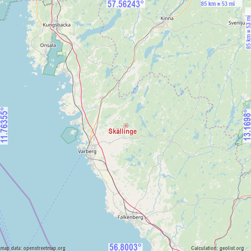
| Upper-left | 57.56243°, | 11.76355° |
| Center: | 57.18333°, | 12.46667° |
| Lower-right: | 56.8003°, | 13.1698° |
| Map W x H: | 84.7×84.7 km | = 52.6×52.6mi |
| max Lat: | 67.85572° ⇑75.7% North |
| Skällinge: | 57.18333° |
| min Lat: | ⇓24.3% South 55.34337° |
| min Long | Skällinge | max Long |
| 11.1712° | 12.46667° | 24.13676° |
| W 11.3%⇐ | ⇒88.7% E |
Elevation
Elevation of Skällinge is 77 m = 253 ft, and this is 5.6 m = 18 ft below average elevation for this country.
| Max E: |
663 m = 2175 ft | 36.8% |
| Avg. | 82.6 m = 271 ft | |
| Skällinge | 77 m = 253 ft | |
Min E: |
-1 m = -3 ft | 63.2% |
See also: Sweden elevation on elevation.city.
Geographical zone
Skällinge is located in North temperate zone (between Tropic of Cancer and the Arctic Circle). Distance of this North polar circle is 1043 km =648.1 mi to North.| Distance of | km | miles | from Skällinge |
|---|---|---|---|
| North Pole | 3648.9 | 2267.3 | to North |
| Arctic Circle | 1043 | 648.1 | to North |
| Tropic Cancer | 3752.3 | 2331.6 | to South |
| Equator | 6358.2 | 3950.8 | to South |


Nearby cities:
15 places around Skällinge: (largest is in red/bold)
• Bua
21.6 km =13.4 mi,  286°
286°
• Frillesås
23.4 km =14.5 mi,  309°
309°
• Horred
19.1 km =11.9 mi,  2°
2°
• Långås
22.3 km =13.9 mi,  182°
182°
• Rolfstorp
3.8 km =2.4 mi,  195°
195°
• Träslövsläge
18.3 km =11.4 mi,  218°
218°
• Trönninge
11.3 km =7 mi,  247°
247°
• Trönningenäs
15.3 km =9.5 mi, 251°
• Tvååker
16.3 km =10.1 mi,  194°
194°
• Tångaberg
14.5 km =9 mi,  265°
265°
• Ullared
16.1 km =10 mi,  110°
110°
• Varberg
15.6 km =9.7 mi,  236°
236°
• Veddige
12.2 km =7.6 mi,  318°
318°
• Väröbacka
18.6 km =11.6 mi, 293°
• Årnäs
15.5 km =9.6 mi,  279°
279°
Sources, notices
• [Note1] Compared only with cities in Sweden existing in our database
• [Src1] Map data: © OpenStreetMap contributors (CC-BY-SA)
• [Src2] Other city data from geonames.org with taken over terms of usage.
• [Src3] Geographical zone / Annual Mean Temperature by Robert A. Rohde @ Wikipedia
