Torsåker geodata
Torsåker (Västernorrland) is a populated place; located in Sweden in Europe/Stockholm (GMT+2) time zone. With population of 873 people, there are 903 cities with bigger population in this country. Compared to other cities in Sweden, 89.1% of cities are located further ↓South; 82.2% of cities are located further ←West and 99.8% of cities have higher elevation than Torsåker. Note1


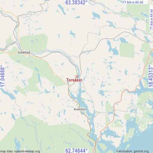
Torsåker GPS coordinates[2]
63° 4' 0.012" North, 17° 45' 0" East
| Map corner | latitude | longitude |
|---|---|---|
| Upper-left | 63.38342°, | 17.04688° |
| Center: | 63.06667°, | 17.75° |
| Lower-right: | 62.74644°, | 18.45313° |
| Map W x H: | 70.8×70.8 km | = 44×44mi |
| max Lat: | 67.85572° ⇑10.9% North |
| Torsåker: | 63.06667° |
| min Lat: | ⇓89.1% South 55.34337° |
| min Long | Torsåker | max Long |
| 11.1712° | 17.75° | 24.13676° |
| W 82.2%⇐ | ⇒17.8% E |
Elevation
Elevation of Torsåker is 1 m = 3 ft, and this is 81.6 m = 268 ft below average elevation for this country.
| Max E: |
663 m = 2175 ft | 99.8% |
| Avg. | 82.6 m = 271 ft | |
| Torsåker | 1 m = 3 ft | |
Min E: |
-1 m = -3 ft | 0.2% |
See also: Sweden elevation on elevation.city.
Geographical zone
Torsåker is located in North temperate zone (between Tropic of Cancer and the Arctic Circle). Distance of this North polar circle is 388.8 km =241.6 mi to North.| Distance of | km | miles | from Torsåker |
|---|---|---|---|
| North Pole | 2994.7 | 1860.8 | to North |
| Arctic Circle | 388.8 | 241.6 | to North |
| Tropic Cancer | 4406.4 | 2738 | to South |
| Equator | 7012.4 | 4357.3 | to South |


Nearby cities:
15 places around Torsåker: (largest is in red/bold)
• Bjästa
40.5 km =25.2 mi,  68°
68°
• Bollstabruk
8.6 km =5.3 mi,  206°
206°
• Bredbyn
45.9 km =28.5 mi,  23°
23°
• Frånö
18.3 km =11.4 mi,  164°
164°
• Härnösand
49.2 km =30.6 mi,  168°
168°
• Kramfors
15.1 km =9.4 mi, 174°
• Kungsgården
8.5 km =5.3 mi,  150°
150°
• Köpmanholmen
42.5 km =26.4 mi, 74°
• Långsele
36.7 km =22.8 mi,  290°
290°
• Mellansel
48.9 km =30.4 mi,  35°
35°
• Nyland
6.7 km =4.2 mi,  175°
175°
• Ramvik
28.3 km =17.6 mi, 169°
• Sollefteå
26.7 km =16.6 mi, 294°
• Älandsbro
43.6 km =27.1 mi, 173°
• Överhörnäs
48.4 km =30.1 mi,  59°
59°
Sources, notices
• [Note1] Compared only with cities in Sweden existing in our database
• [Src1] Map data: © OpenStreetMap contributors (CC-BY-SA)
• [Src2] Other city data from geonames.org with taken over terms of usage.
• [Src3] Geographical zone / Annual Mean Temperature by Robert A. Rohde @ Wikipedia
