Älandsbro geodata
Älandsbro (Västernorrland) is a populated place; located in Sweden in Europe/Stockholm (GMT+2) time zone. With population of 928 people, there are 863 cities with bigger population in this country. Compared to other cities in Sweden, 88.1% of cities are located further ↓South; 83.5% of cities are located further ←West and 78.5% of cities have higher elevation than Älandsbro. Note1
Administrative division(s):
- Level 1: Västernorrland
- Level 2: Härnösands Kommun
- Level 3: Säbrå
- Level 4: Säbrå socken


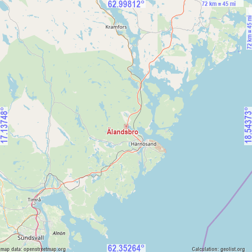
Älandsbro GPS coordinates[2]
62° 40' 37.704" North, 17° 50' 26.16" East
| Map corner | latitude | longitude |
|---|---|---|
| Upper-left | 62.99812°, | 17.13748° |
| Center: | 62.67714°, | 17.8406° |
| Lower-right: | 62.35264°, | 18.54373° |
| Map W x H: | 71.8×71.8 km | = 44.6×44.6mi |
| max Lat: | 67.85572° ⇑11.9% North |
| Älandsbro: | 62.67714° |
| min Lat: | ⇓88.1% South 55.34337° |
| min Long | Älandsbro | max Long |
| 11.1712° | 17.8406° | 24.13676° |
| W 83.5%⇐ | ⇒16.5% E |
Elevation
Elevation of Älandsbro is 17 m = 56 ft, and this is 65.6 m = 215 ft below average elevation for this country.
| Max E: |
663 m = 2175 ft | 78.5% |
| Avg. | 82.6 m = 271 ft | |
| Älandsbro | 17 m = 56 ft | |
Min E: |
-1 m = -3 ft | 21.5% |
See also: Sweden elevation on elevation.city.
Geographical zone
Älandsbro is located in North temperate zone (between Tropic of Cancer and the Arctic Circle). Distance of this North polar circle is 432.1 km =268.5 mi to North.| Distance of | km | miles | from Älandsbro |
|---|---|---|---|
| North Pole | 3038 | 1887.7 | to North |
| Arctic Circle | 432.1 | 268.5 | to North |
| Tropic Cancer | 4363.1 | 2711.1 | to South |
| Equator | 6969 | 4330.3 | to South |


Nearby cities:
15 places around Älandsbro: (largest is in red/bold)
• Bergeforsen
28.6 km =17.8 mi,  235°
235°
• Bollstabruk
36.6 km =22.7 mi,  346°
346°
• Frånö
25.7 km =16 mi,  0°
0°
• Härnösand
7 km =4.3 mi,  135°
135°
• Indal
39.5 km =24.5 mi,  253°
253°
• Johannedal
36.1 km =22.4 mi,  221°
221°
• Kramfors
28.5 km =17.7 mi, 353°
• Kungsgården
35.9 km =22.3 mi,  359°
359°
• Nyland
36.8 km =22.9 mi, 353°
• Ramvik
15.5 km =9.6 mi, 1°
• Sundsbruk
35 km =21.7 mi,  225°
225°
• Svartvik
10.7 km =6.6 mi,  161°
161°
• Söråker
25.5 km =15.8 mi, 221°
• Timrå
33.8 km =21 mi, 231°
• Vi
34.7 km =21.6 mi, 218°
Sources, notices
• [Note1] Compared only with cities in Sweden existing in our database
• [Src1] Map data: © OpenStreetMap contributors (CC-BY-SA)
• [Src2] Other city data from geonames.org with taken over terms of usage.
• [Src3] Geographical zone / Annual Mean Temperature by Robert A. Rohde @ Wikipedia
