Bollstabruk geodata
Bollstabruk (Västernorrland) is a populated place; located in Sweden in Europe/Stockholm (GMT+2) time zone. With population of 1,883 people, there are 549 cities with bigger population in this country. Compared to other cities in Sweden, 88.8% of cities are located further ↓South; 81.3% of cities are located further ←West and 98.2% of cities have higher elevation than Bollstabruk. Note1
Administrative division(s):
- Level 1: Västernorrland
- Level 2: Kramfors Kommun
- Level 3: Ytterlännäs
- Level 4: Ytterlännäs socken


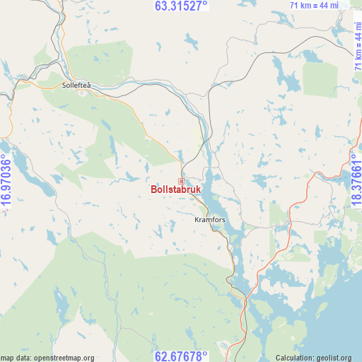
Bollstabruk GPS coordinates[2]
62° 59' 51.972" North, 17° 40' 24.528" East
| Map corner | latitude | longitude |
|---|---|---|
| Upper-left | 63.31527°, | 16.97036° |
| Center: | 62.99777°, | 17.67348° |
| Lower-right: | 62.67678°, | 18.37661° |
| Map W x H: | 71×71 km | = 44.1×44.1mi |
| max Lat: | 67.85572° ⇑11.2% North |
| Bollstabruk: | 62.99777° |
| min Lat: | ⇓88.8% South 55.34337° |
| min Long | Bollstabruk | max Long |
| 11.1712° | 17.67348° | 24.13676° |
| W 81.3%⇐ | ⇒18.7% E |
Elevation
Elevation of Bollstabruk is 2 m = 7 ft, and this is 80.6 m = 264 ft below average elevation for this country.
| Max E: |
663 m = 2175 ft | 98.2% |
| Avg. | 82.6 m = 271 ft | |
| Bollstabruk | 2 m = 7 ft | |
Min E: |
-1 m = -3 ft | 1.8% |
See also: Sweden elevation on elevation.city.
Geographical zone
Bollstabruk is located in North temperate zone (between Tropic of Cancer and the Arctic Circle). Distance of this North polar circle is 396.5 km =246.4 mi to North.| Distance of | km | miles | from Bollstabruk |
|---|---|---|---|
| North Pole | 3002.4 | 1865.6 | to North |
| Arctic Circle | 396.5 | 246.4 | to North |
| Tropic Cancer | 4398.8 | 2733.3 | to South |
| Equator | 7004.7 | 4352.5 | to South |


Nearby cities:
15 places around Bollstabruk: (largest is in red/bold)
• Bergeforsen
54 km =33.6 mi,  195°
195°
• Bjästa
47.3 km =29.4 mi,  61°
61°
• Bredbyn
54.5 km =33.9 mi,  23°
23°
• Frånö
13.3 km =8.3 mi,  138°
138°
• Härnösand
42.8 km =26.6 mi,  161°
161°
• Kramfors
9 km =5.6 mi, 144°
• Kungsgården
8.1 km =5 mi,  88°
88°
• Köpmanholmen
48.7 km =30.3 mi,  67°
67°
• Långsele
36.9 km =22.9 mi,  304°
304°
• Nyland
4.4 km =2.7 mi,  77°
77°
• Ramvik
22 km =13.7 mi, 156°
• Sollefteå
27.8 km =17.3 mi,  312°
312°
• Svartvik
47.3 km =29.4 mi,  165°
165°
• Torsåker
8.6 km =5.3 mi,  26°
26°
• Älandsbro
36.6 km =22.7 mi, 166°
Sources, notices
• [Note1] Compared only with cities in Sweden existing in our database
• [Src1] Map data: © OpenStreetMap contributors (CC-BY-SA)
• [Src2] Other city data from geonames.org with taken over terms of usage.
• [Src3] Geographical zone / Annual Mean Temperature by Robert A. Rohde @ Wikipedia
