Svenljunga geodata
Svenljunga (Västra Götaland) is a seat of a second-order administrative division; located in Sweden in Europe/Stockholm (GMT+2) time zone. With population of 3,592 people, there are 357 cities with bigger population in this country. Compared to other cities in Sweden, 71.7% of cities are located further ↑North; 77.2% of cities are located further →East and 81.1% of cities have lower elevation than Svenljunga. Note1


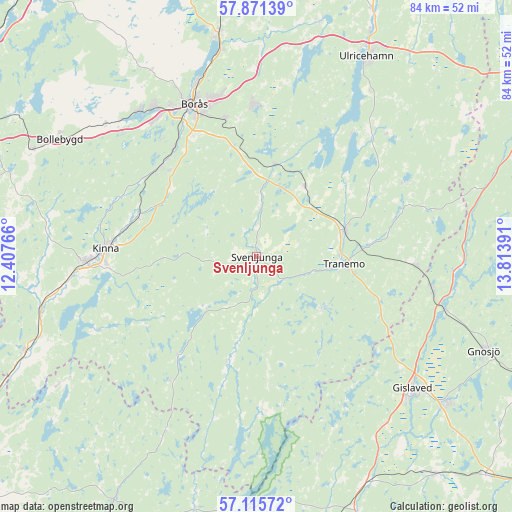
Svenljunga GPS coordinates[2]
57° 29' 43.836" North, 13° 6' 38.808" East
| Map corner | latitude | longitude |
|---|---|---|
| Upper-left | 57.87139°, | 12.40766° |
| Center: | 57.49551°, | 13.11078° |
| Lower-right: | 57.11572°, | 13.81391° |
| Map W x H: | 84×84 km | = 52.2×52.2mi |
| max Lat: | 67.85572° ⇑71.7% North |
| Svenljunga: | 57.49551° |
| min Lat: | ⇓28.3% South 55.34337° |
| min Long | Svenljunga | max Long |
| 11.1712° | 13.11078° | 24.13676° |
| W 22.8%⇐ | ⇒77.2% E |
Elevation
Elevation of Svenljunga is 149 m = 489 ft, and this is 66.4 m = 218 ft above average elevation for this country.
| Max E: |
663 m = 2175 ft | 18.9% |
| Svenljunga | 149 m 489 ft | |
| Avg. | 82.6 m = 271 ft | |
Min E: |
-1 m = -3 ft | 81.1% |
See also: Sweden elevation on elevation.city.
Geographical zone
Svenljunga is located in North temperate zone (between Tropic of Cancer and the Arctic Circle). Distance of this North polar circle is 1008.3 km =626.5 mi to North.| Distance of | km | miles | from Svenljunga |
|---|---|---|---|
| North Pole | 3614.2 | 2245.8 | to North |
| Arctic Circle | 1008.3 | 626.5 | to North |
| Tropic Cancer | 3787 | 2353.1 | to South |
| Equator | 6392.9 | 3972.4 | to South |


Nearby cities:
15 places around Svenljunga: (largest is in red/bold)
• Dalsjöfors
24.6 km =15.3 mi,  356°
356°
• Fritsla
20.6 km =12.8 mi,  289°
289°
• Grimsås
26.3 km =16.3 mi,  92°
92°
• Gånghester
23.4 km =14.5 mi,  346°
346°
• Hillared
15.5 km =9.6 mi,  8°
8°
• Kinna
24.9 km =15.5 mi,  273°
273°
• Limmared
15.3 km =9.5 mi,  72°
72°
• Länghem
13.7 km =8.5 mi,  32°
32°
• Målsryd
21.2 km =13.2 mi, 350°
• Rydboholm
21.9 km =13.6 mi,  321°
321°
• Sexdrega
9.8 km =6.1 mi,  2°
2°
• Svaneholm
22.1 km =13.7 mi,  307°
307°
• Tranemo
14.4 km =8.9 mi,  95°
95°
• Viskafors
21.6 km =13.4 mi, 313°
• Överlida
20.7 km =12.9 mi,  218°
218°
Sources, notices
• [Note1] Compared only with cities in Sweden existing in our database
• [Src1] Map data: © OpenStreetMap contributors (CC-BY-SA)
• [Src2] Other city data from geonames.org with taken over terms of usage.
• [Src3] Geographical zone / Annual Mean Temperature by Robert A. Rohde @ Wikipedia
