Fritsla geodata
Fritsla (Västra Götaland) is a populated place; located in Sweden in Europe/Stockholm (GMT+2) time zone. With population of 2,307 people, there are 476 cities with bigger population in this country. Compared to other cities in Sweden, 70.9% of cities are located further ↑North; 84.9% of cities are located further →East and 65.7% of cities have lower elevation than Fritsla. Note1
Administrative division(s):
- Level 1: Västra Götaland
- Level 2: Marks Kommun
- Level 3: Fritsla
- Level 4: Fritsla socken


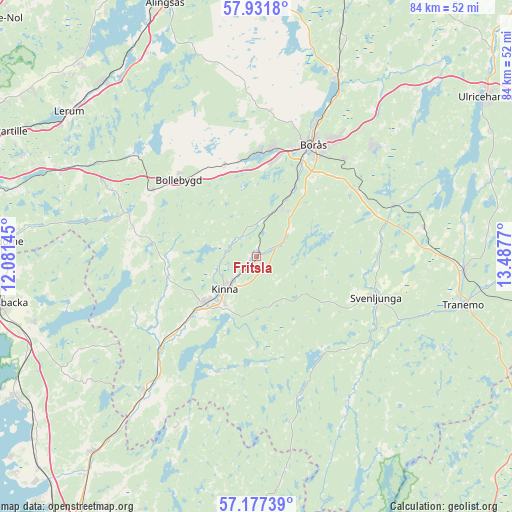
Fritsla GPS coordinates[2]
57° 33' 23.58" North, 12° 47' 4.452" East
| Map corner | latitude | longitude |
|---|---|---|
| Upper-left | 57.9318°, | 12.08145° |
| Center: | 57.55655°, | 12.78457° |
| Lower-right: | 57.17739°, | 13.4877° |
| Map W x H: | 83.9×83.9 km | = 52.1×52.1mi |
| max Lat: | 67.85572° ⇑70.9% North |
| Fritsla: | 57.55655° |
| min Lat: | ⇓29.1% South 55.34337° |
| min Long | Fritsla | max Long |
| 11.1712° | 12.78457° | 24.13676° |
| W 15.1%⇐ | ⇒84.9% E |
Elevation
Elevation of Fritsla is 85 m = 279 ft, and this is 2.4 m = 8 ft above average elevation for this country.
| Max E: |
663 m = 2175 ft | 34.3% |
| Fritsla | 85 m 279 ft | |
| Avg. | 82.6 m = 271 ft | |
Min E: |
-1 m = -3 ft | 65.7% |
See also: Sweden elevation on elevation.city.
Geographical zone
Fritsla is located in North temperate zone (between Tropic of Cancer and the Arctic Circle). Distance of this North polar circle is 1001.5 km =622.3 mi to North.| Distance of | km | miles | from Fritsla |
|---|---|---|---|
| North Pole | 3607.4 | 2241.5 | to North |
| Arctic Circle | 1001.5 | 622.3 | to North |
| Tropic Cancer | 3793.8 | 2357.4 | to South |
| Equator | 6399.7 | 3976.6 | to South |


Nearby cities:
15 places around Fritsla: (largest is in red/bold)
• Bollebygd
17.7 km =11 mi,  314°
314°
• Borås
20.5 km =12.7 mi,  26°
26°
• Gånghester
21.1 km =13.1 mi,  40°
40°
• Hyssna
14.7 km =9.1 mi,  270°
270°
• Kinna
7.7 km =4.8 mi,  224°
224°
• Olsfors
15.8 km =9.8 mi,  340°
340°
• Rydboholm
11.9 km =7.4 mi, 29°
• Rävlanda
20.2 km =12.6 mi,  302°
302°
• Sandared
17.1 km =10.6 mi,  1°
1°
• Sexdrega
20 km =12.4 mi,  81°
81°
• Sjömarken
17.9 km =11.1 mi,  9°
9°
• Svaneholm
7 km =4.3 mi,  15°
15°
• Svenljunga
20.6 km =12.8 mi,  109°
109°
• Sätila
21 km =13 mi, 265°
• Viskafors
9 km =5.6 mi, 25°
Sources, notices
• [Note1] Compared only with cities in Sweden existing in our database
• [Src1] Map data: © OpenStreetMap contributors (CC-BY-SA)
• [Src2] Other city data from geonames.org with taken over terms of usage.
• [Src3] Geographical zone / Annual Mean Temperature by Robert A. Rohde @ Wikipedia
