Stora Vika geodata
Stora Vika (Stockholm) is a populated place; located in Sweden in Europe/Stockholm (GMT+2) time zone. With population of 695 people, there are 1070 cities with bigger population in this country. Compared to other cities in Sweden, 53% of cities are located further ↓South; 82.7% of cities are located further ←West and 80.1% of cities have higher elevation than Stora Vika. Note1


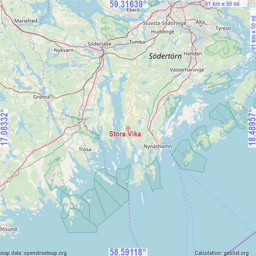
Stora Vika GPS coordinates[2]
58° 57' 20.484" North, 17° 47' 11.184" East
| Map corner | latitude | longitude |
|---|---|---|
| Upper-left | 59.31639°, | 17.08332° |
| Center: | 58.95569°, | 17.78644° |
| Lower-right: | 58.59118°, | 18.48957° |
| Map W x H: | 80.6×80.6 km | = 50.1×50.1mi |
| max Lat: | 67.85572° ⇑47% North |
| Stora Vika: | 58.95569° |
| min Lat: | ⇓53% South 55.34337° |
| min Long | Stora Vika | max Long |
| 11.1712° | 17.78644° | 24.13676° |
| W 82.7%⇐ | ⇒17.3% E |
Elevation
Elevation of Stora Vika is 16 m = 52 ft, and this is 66.6 m = 219 ft below average elevation for this country.
| Max E: |
663 m = 2175 ft | 80.1% |
| Avg. | 82.6 m = 271 ft | |
| Stora Vika | 16 m = 52 ft | |
Min E: |
-1 m = -3 ft | 19.9% |
See also: Sweden elevation on elevation.city.
Geographical zone
Stora Vika is located in North temperate zone (between Tropic of Cancer and the Arctic Circle). Distance of this North polar circle is 845.9 km =525.6 mi to North.| Distance of | km | miles | from Stora Vika |
|---|---|---|---|
| North Pole | 3451.8 | 2144.8 | to North |
| Arctic Circle | 845.9 | 525.6 | to North |
| Tropic Cancer | 3949.3 | 2454 | to South |
| Equator | 6555.3 | 4073.3 | to South |


Nearby cities:
15 places around Stora Vika: (largest is in red/bold)
• Grödby
11.9 km =7.4 mi,  27°
27°
• Hölö
16 km =9.9 mi,  295°
295°
• Järna
19.7 km =12.2 mi,  320°
320°
• Mölnbo
23.6 km =14.7 mi, 296°
• Nynäshamn
10.9 km =6.8 mi,  122°
122°
• Pershagen
23.4 km =14.5 mi,  341°
341°
• Rönninge
27.3 km =17 mi,  353°
353°
• Segersäng
11.6 km =7.2 mi,  46°
46°
• Södertälje
28.2 km =17.5 mi, 340°
• Trosa
15.2 km =9.4 mi,  244°
244°
• Tullinge
27.9 km =17.3 mi,  13°
13°
• Tumba
27.1 km =16.8 mi, 5°
• Vagnhärad
17.2 km =10.7 mi,  266°
266°
• Vårsta
23.3 km =14.5 mi,  1°
1°
• Ösmo
7.2 km =4.5 mi,  64°
64°
Sources, notices
• [Note1] Compared only with cities in Sweden existing in our database
• [Src1] Map data: © OpenStreetMap contributors (CC-BY-SA)
• [Src2] Other city data from geonames.org with taken over terms of usage.
• [Src3] Geographical zone / Annual Mean Temperature by Robert A. Rohde @ Wikipedia
