Segersäng geodata
Segersäng (Stockholm) is a populated locality; located in Sweden in Europe/Stockholm (GMT+2) time zone. With population of 757 people, there are 1007 cities with bigger population in this country. Compared to other cities in Sweden, 53.7% of cities are located further ↓South; 85% of cities are located further ←West and 55.2% of cities have higher elevation than Segersäng. Note1
Administrative division(s):
- Level 1: Stockholm
- Level 2: Nynäshamns kommun
- Level 3: Ösmo-Torö
- Level 4: Ösmo socken


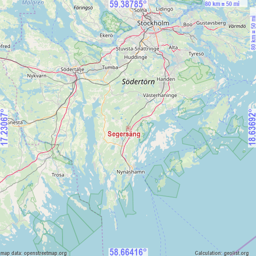
Segersäng GPS coordinates[2]
59° 1' 40.476" North, 17° 56' 1.644" East
| Map corner | latitude | longitude |
|---|---|---|
| Upper-left | 59.38785°, | 17.23067° |
| Center: | 59.02791°, | 17.93379° |
| Lower-right: | 58.66416°, | 18.63692° |
| Map W x H: | 80.5×80.5 km | = 50×50mi |
| max Lat: | 67.85572° ⇑46.3% North |
| Segersäng: | 59.02791° |
| min Lat: | ⇓53.7% South 55.34337° |
| min Long | Segersäng | max Long |
| 11.1712° | 17.93379° | 24.13676° |
| W 85%⇐ | ⇒15% E |
Elevation
Elevation of Segersäng is 42 m = 138 ft, and this is 40.6 m = 133 ft below average elevation for this country.
| Max E: |
663 m = 2175 ft | 55.2% |
| Avg. | 82.6 m = 271 ft | |
| Segersäng | 42 m = 138 ft | |
Min E: |
-1 m = -3 ft | 44.8% |
See also: Sweden elevation on elevation.city.
Geographical zone
Segersäng is located in North temperate zone (between Tropic of Cancer and the Arctic Circle). Distance of this North polar circle is 837.9 km =520.6 mi to North.| Distance of | km | miles | from Segersäng |
|---|---|---|---|
| North Pole | 3443.8 | 2139.9 | to North |
| Arctic Circle | 837.9 | 520.6 | to North |
| Tropic Cancer | 3957.4 | 2459 | to South |
| Equator | 6563.3 | 4078.2 | to South |


Nearby cities:
15 places around Segersäng: (largest is in red/bold)
• Grödby
3.8 km =2.4 mi,  310°
310°
• Handen
19.5 km =12.1 mi,  36°
36°
• Haninge
19.7 km =12.2 mi, 37°
• Hölö
23 km =14.3 mi,  266°
266°
• Jordbro
17.1 km =10.6 mi, 37°
• Järna
22.2 km =13.8 mi,  288°
288°
• Nynäshamn
13.9 km =8.6 mi,  176°
176°
• Pershagen
21.4 km =13.3 mi, 311°
• Rönninge
22.3 km =13.9 mi,  329°
329°
• Stora Vika
11.6 km =7.2 mi,  226°
226°
• Tullinge
19.2 km =11.9 mi,  354°
354°
• Tumba
19.8 km =12.3 mi,  343°
343°
• Vidja
20.6 km =12.8 mi,  21°
21°
• Vårsta
17.1 km =10.6 mi, 332°
• Ösmo
5.3 km =3.3 mi,  201°
201°
Sources, notices
• [Note1] Compared only with cities in Sweden existing in our database
• [Src1] Map data: © OpenStreetMap contributors (CC-BY-SA)
• [Src2] Other city data from geonames.org with taken over terms of usage.
• [Src3] Geographical zone / Annual Mean Temperature by Robert A. Rohde @ Wikipedia
