Stockvik geodata
Stockvik (Västernorrland) is a populated place; located in Sweden in Europe/Stockholm (GMT+2) time zone. With population of 2,532 people, there are 452 cities with bigger population in this country. Compared to other cities in Sweden, 86.4% of cities are located further ↓South; 77.9% of cities are located further ←West and 99.8% of cities have higher elevation than Stockvik. Note1
Administrative division(s):
- Level 1: Västernorrland
- Level 2: Sundsvalls Kommun
- Level 3: Njurunda
- Level 4: Njurunda socken


Stockvik GPS coordinates[2]
62° 20' 12.012" North, 17° 21' 56.988" East
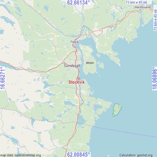
| Map corner | latitude | longitude |
|---|---|---|
| Upper-left | 62.66134°, | 16.66271° |
| Center: | 62.33667°, | 17.36583° |
| Lower-right: | 62.00845°, | 18.06896° |
| Map W x H: | 72.6×72.6 km | = 45.1×45.1mi |
| max Lat: | 67.85572° ⇑13.6% North |
| Stockvik: | 62.33667° |
| min Lat: | ⇓86.4% South 55.34337° |
| min Long | Stockvik | max Long |
| 11.1712° | 17.36583° | 24.13676° |
| W 77.9%⇐ | ⇒22.1% E |
Elevation
Elevation of Stockvik is 1 m = 3 ft, and this is 81.6 m = 268 ft below average elevation for this country.
| Max E: |
663 m = 2175 ft | 99.8% |
| Avg. | 82.6 m = 271 ft | |
| Stockvik | 1 m = 3 ft | |
Min E: |
-1 m = -3 ft | 0.2% |
See also: Sweden elevation on elevation.city.
Geographical zone
Stockvik is located in North temperate zone (between Tropic of Cancer and the Arctic Circle). Distance of this North polar circle is 470 km =292 mi to North.| Distance of | km | miles | from Stockvik |
|---|---|---|---|
| North Pole | 3075.9 | 1911.3 | to North |
| Arctic Circle | 470 | 292 | to North |
| Tropic Cancer | 4325.3 | 2687.6 | to South |
| Equator | 6931.2 | 4306.8 | to South |


Nearby cities:
15 places around Stockvik: (largest is in red/bold)
• Ankarsvik
4.4 km =2.7 mi,  32°
32°
• Dingersjö
6.9 km =4.3 mi,  173°
173°
• Essvik
2.7 km =1.7 mi,  148°
148°
• Johannedal
10.9 km =6.8 mi,  1°
1°
• Klingsta
7.7 km =4.8 mi,  261°
261°
• Kvissleby
4.8 km =3 mi, 174°
• Lucksta
16.9 km =10.5 mi, 255°
• Njurundabommen
8.2 km =5.1 mi, 173°
• Nolby
5.5 km =3.4 mi,  178°
178°
• Skottsund
5.2 km =3.2 mi, 167°
• Sundsbruk
13.5 km =8.4 mi,  356°
356°
• Sundsvall
6.8 km =4.2 mi,  333°
333°
• Timrå
16.8 km =10.4 mi,  353°
353°
• Vi
11.1 km =6.9 mi,  13°
13°
• Vi
11.1 km =6.9 mi,  248°
248°
Sources, notices
• [Note1] Compared only with cities in Sweden existing in our database
• [Src1] Map data: © OpenStreetMap contributors (CC-BY-SA)
• [Src2] Other city data from geonames.org with taken over terms of usage.
• [Src3] Geographical zone / Annual Mean Temperature by Robert A. Rohde @ Wikipedia
