Saxdalen geodata
Saxdalen (Dalarna) is a populated place; located in Sweden in Europe/Stockholm (GMT+2) time zone. With population of 620 people, there are 1155 cities with bigger population in this country. Compared to other cities in Sweden, 75.1% of cities are located further ↓South; 50.8% of cities are located further →East and 86.4% of cities have lower elevation than Saxdalen. Note1


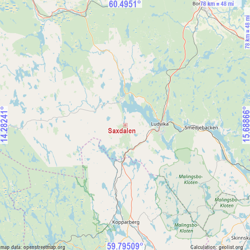
Saxdalen GPS coordinates[2]
60° 8' 49.056" North, 14° 59' 7.908" East
| Map corner | latitude | longitude |
|---|---|---|
| Upper-left | 60.4951°, | 14.28241° |
| Center: | 60.14696°, | 14.98553° |
| Lower-right: | 59.79509°, | 15.68866° |
| Map W x H: | 77.8×77.8 km | = 48.3×48.3mi |
| max Lat: | 67.85572° ⇑24.9% North |
| Saxdalen: | 60.14696° |
| min Lat: | ⇓75.1% South 55.34337° |
| min Long | Saxdalen | max Long |
| 11.1712° | 14.98553° | 24.13676° |
| W 49.2%⇐ | ⇒50.8% E |
Elevation
Elevation of Saxdalen is 175 m = 574 ft, and this is 92.4 m = 303 ft above average elevation for this country.
| Max E: |
663 m = 2175 ft | 13.6% |
| Saxdalen | 175 m 574 ft | |
| Avg. | 82.6 m = 271 ft | |
Min E: |
-1 m = -3 ft | 86.4% |
See also: Sweden elevation on elevation.city.
Geographical zone
Saxdalen is located in North temperate zone (between Tropic of Cancer and the Arctic Circle). Distance of this North polar circle is 713.5 km =443.3 mi to North.| Distance of | km | miles | from Saxdalen |
|---|---|---|---|
| North Pole | 3319.3 | 2062.5 | to North |
| Arctic Circle | 713.5 | 443.3 | to North |
| Tropic Cancer | 4081.8 | 2536.3 | to South |
| Equator | 6687.7 | 4155.5 | to South |


Nearby cities:
15 places around Saxdalen: (largest is in red/bold)
• Abborrberget
10.3 km =6.4 mi,  271°
271°
• Björbo
37.8 km =23.5 mi,  336°
336°
• Floda
41.3 km =25.7 mi,  345°
345°
• Fredriksberg
33.4 km =20.8 mi, 267°
• Grängesberg
8.1 km =5 mi,  171°
171°
• Kopparberg
30.1 km =18.7 mi,  179°
179°
• Ludvika
11.2 km =7 mi,  88°
88°
• Mockfjärd
39.3 km =24.4 mi,  358°
358°
• Mora
44 km =27.3 mi,  50°
50°
• Nyhammar
15.2 km =9.4 mi, 356°
• Romme
42.6 km =26.5 mi,  41°
41°
• Smedjebacken
23.7 km =14.7 mi, 91°
• Sunnansjö
8 km =5 mi, 345°
• Söderbärke
33 km =20.5 mi,  105°
105°
• Sörvik
10.3 km =6.4 mi,  66°
66°
Sources, notices
• [Note1] Compared only with cities in Sweden existing in our database
• [Src1] Map data: © OpenStreetMap contributors (CC-BY-SA)
• [Src2] Other city data from geonames.org with taken over terms of usage.
• [Src3] Geographical zone / Annual Mean Temperature by Robert A. Rohde @ Wikipedia
