Sörvik geodata
Sörvik (Dalarna) is a populated place; located in Sweden in Europe/Stockholm (GMT+2) time zone. With population of 699 people, there are 1066 cities with bigger population in this country. Compared to other cities in Sweden, 75.8% of cities are located further ↓South; 51.8% of cities are located further ←West and 86.4% of cities have lower elevation than Sörvik. Note1
Administrative division(s):
- Level 1: Dalarna
- Level 2: Ludvika Kommun
- Level 3: Ludvika
- Level 4: Ludvika socken


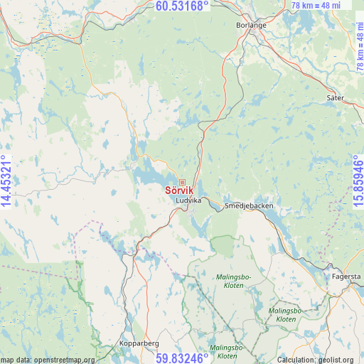
Sörvik GPS coordinates[2]
60° 11' 2.148" North, 15° 9' 22.788" East
| Map corner | latitude | longitude |
|---|---|---|
| Upper-left | 60.53168°, | 14.45321° |
| Center: | 60.18393°, | 15.15633° |
| Lower-right: | 59.83246°, | 15.85946° |
| Map W x H: | 77.7×77.7 km | = 48.3×48.3mi |
| max Lat: | 67.85572° ⇑24.2% North |
| Sörvik: | 60.18393° |
| min Lat: | ⇓75.8% South 55.34337° |
| min Long | Sörvik | max Long |
| 11.1712° | 15.15633° | 24.13676° |
| W 51.8%⇐ | ⇒48.2% E |
Elevation
Elevation of Sörvik is 175 m = 574 ft, and this is 92.4 m = 303 ft above average elevation for this country.
| Max E: |
663 m = 2175 ft | 13.6% |
| Sörvik | 175 m 574 ft | |
| Avg. | 82.6 m = 271 ft | |
Min E: |
-1 m = -3 ft | 86.4% |
See also: Sweden elevation on elevation.city.
Geographical zone
Sörvik is located in North temperate zone (between Tropic of Cancer and the Arctic Circle). Distance of this North polar circle is 709.3 km =440.7 mi to North.| Distance of | km | miles | from Sörvik |
|---|---|---|---|
| North Pole | 3315.2 | 2060 | to North |
| Arctic Circle | 709.3 | 440.7 | to North |
| Tropic Cancer | 4085.9 | 2538.9 | to South |
| Equator | 6691.8 | 4158.1 | to South |


Nearby cities:
15 places around Sörvik: (largest is in red/bold)
• Abborrberget
20.1 km =12.5 mi,  259°
259°
• Borlänge
37 km =23 mi,  24°
24°
• Enbacka
34.9 km =21.7 mi,  43°
43°
• Grängesberg
14.7 km =9.1 mi,  214°
214°
• Kopparberg
35.4 km =22 mi,  194°
194°
• Ludvika
4.2 km =2.6 mi,  155°
155°
• Mockfjärd
36.7 km =22.8 mi,  343°
343°
• Mora
34.3 km =21.3 mi,  45°
45°
• Nyhammar
15.2 km =9.4 mi,  316°
316°
• Romme
33.6 km =20.9 mi,  34°
34°
• Saxdalen
10.3 km =6.4 mi,  246°
246°
• Smedjebacken
15 km =9.3 mi,  108°
108°
• Sunnansjö
12 km =7.5 mi,  287°
287°
• Säter
37.5 km =23.3 mi,  60°
60°
• Söderbärke
25.7 km =16 mi,  119°
119°
Sources, notices
• [Note1] Compared only with cities in Sweden existing in our database
• [Src1] Map data: © OpenStreetMap contributors (CC-BY-SA)
• [Src2] Other city data from geonames.org with taken over terms of usage.
• [Src3] Geographical zone / Annual Mean Temperature by Robert A. Rohde @ Wikipedia
