Hammerdal geodata
Hammerdal (Jämtland) is a populated place; located in Sweden in Europe/Stockholm (GMT+2) time zone. With population of 1,043 people, there are 792 cities with bigger population in this country. Compared to other cities in Sweden, 91.8% of cities are located further ↓South; 54% of cities are located further ←West and 95.8% of cities have lower elevation than Hammerdal. Note1


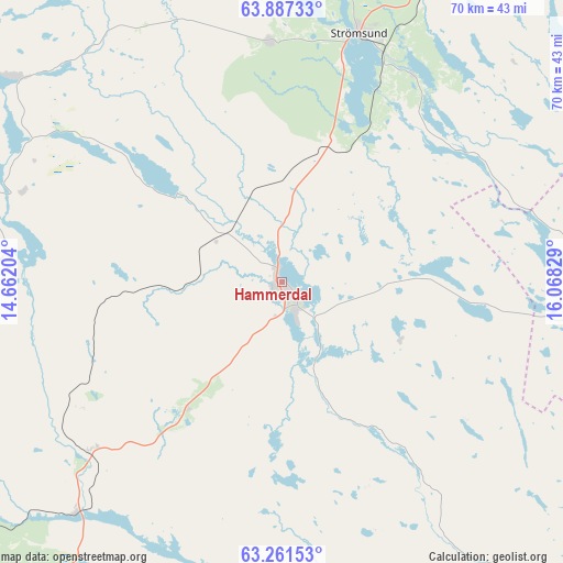
Hammerdal GPS coordinates[2]
63° 34' 34.14" North, 15° 21' 54.576" East
| Map corner | latitude | longitude |
|---|---|---|
| Upper-left | 63.88733°, | 14.66204° |
| Center: | 63.57615°, | 15.36516° |
| Lower-right: | 63.26153°, | 16.06829° |
| Map W x H: | 69.6×69.6 km | = 43.2×43.2mi |
| max Lat: | 67.85572° ⇑8.2% North |
| Hammerdal: | 63.57615° |
| min Lat: | ⇓91.8% South 55.34337° |
| min Long | Hammerdal | max Long |
| 11.1712° | 15.36516° | 24.13676° |
| W 54%⇐ | ⇒46% E |
Elevation
Elevation of Hammerdal is 290 m = 951 ft, and this is 207.4 m = 680 ft above average elevation for this country.
| Max E: |
663 m = 2175 ft | 4.2% |
| Hammerdal | 290 m 951 ft | |
| Avg. | 82.6 m = 271 ft | |
Min E: |
-1 m = -3 ft | 95.8% |
See also: Sweden elevation on elevation.city.
Geographical zone
Hammerdal is located in North temperate zone (between Tropic of Cancer and the Arctic Circle). Distance of this North polar circle is 332.2 km =206.4 mi to North.| Distance of | km | miles | from Hammerdal |
|---|---|---|---|
| North Pole | 2938.1 | 1825.7 | to North |
| Arctic Circle | 332.2 | 206.4 | to North |
| Tropic Cancer | 4463.1 | 2773.2 | to South |
| Equator | 7069 | 4392.5 | to South |


Nearby cities:
15 places around Hammerdal: (largest is in red/bold)
• Backe
57.6 km =35.8 mi,  62°
62°
• Brunflo
61.7 km =38.3 mi,  205°
205°
• Dvärsätt
53.2 km =33.1 mi,  237°
237°
• Föllinge
38.3 km =23.8 mi,  285°
285°
• Hållsta
67.1 km =41.7 mi,  197°
197°
• Krokom
53.4 km =33.2 mi, 238°
• Lit
38.4 km =23.9 mi,  222°
222°
• Nälden
60.8 km =37.8 mi,  245°
245°
• Ramsele
54.8 km =34.1 mi,  94°
94°
• Strömsund
32.1 km =19.9 mi,  17°
17°
• Stugun
47 km =29.2 mi,  165°
165°
• Sörvik
64.3 km =40 mi, 15°
• Ås
53.8 km =33.4 mi,  227°
227°
• Ås
64.8 km =40.3 mi,  111°
111°
• Östersund
57.2 km =35.5 mi, 219°
Sources, notices
• [Note1] Compared only with cities in Sweden existing in our database
• [Src1] Map data: © OpenStreetMap contributors (CC-BY-SA)
• [Src2] Other city data from geonames.org with taken over terms of usage.
• [Src3] Geographical zone / Annual Mean Temperature by Robert A. Rohde @ Wikipedia
