Gnarp geodata
Gnarp (Gävleborg) is a populated place; located in Sweden in Europe/Stockholm (GMT+2) time zone. With population of 1,199 people, there are 742 cities with bigger population in this country. Compared to other cities in Sweden, 85.5% of cities are located further ↓South; 77.2% of cities are located further ←West and 65.3% of cities have higher elevation than Gnarp. Note1
Administrative division(s):
- Level 1: Gävleborg
- Level 2: Nordanstigs kommun
- Level 3: Gnarp
- Level 4: Gnarp socken


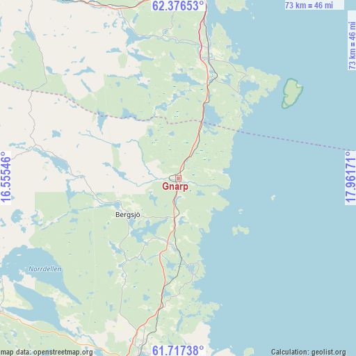
Gnarp GPS coordinates[2]
62° 2' 55.464" North, 17° 15' 30.888" East
| Map corner | latitude | longitude |
|---|---|---|
| Upper-left | 62.37653°, | 16.55546° |
| Center: | 62.04874°, | 17.25858° |
| Lower-right: | 61.71738°, | 17.96171° |
| Map W x H: | 73.3×73.3 km | = 45.5×45.5mi |
| max Lat: | 67.85572° ⇑14.5% North |
| Gnarp: | 62.04874° |
| min Lat: | ⇓85.5% South 55.34337° |
| min Long | Gnarp | max Long |
| 11.1712° | 17.25858° | 24.13676° |
| W 77.2%⇐ | ⇒22.8% E |
Elevation
Elevation of Gnarp is 30 m = 98 ft, and this is 52.6 m = 173 ft below average elevation for this country.
| Max E: |
663 m = 2175 ft | 65.3% |
| Avg. | 82.6 m = 271 ft | |
| Gnarp | 30 m = 98 ft | |
Min E: |
-1 m = -3 ft | 34.7% |
See also: Sweden elevation on elevation.city.
Geographical zone
Gnarp is located in North temperate zone (between Tropic of Cancer and the Arctic Circle). Distance of this North polar circle is 502 km =311.9 mi to North.| Distance of | km | miles | from Gnarp |
|---|---|---|---|
| North Pole | 3107.9 | 1931.2 | to North |
| Arctic Circle | 502 | 311.9 | to North |
| Tropic Cancer | 4293.3 | 2667.7 | to South |
| Equator | 6899.2 | 4287 | to South |


Nearby cities:
15 places around Gnarp: (largest is in red/bold)
• Ankarsvik
36.6 km =22.7 mi,  12°
12°
• Bergsjö
12.6 km =7.8 mi,  234°
234°
• Dingersjö
25.9 km =16.1 mi, 14°
• Essvik
30.6 km =19 mi, 13°
• Harmånger
13.6 km =8.5 mi,  188°
188°
• Hudiksvall
36.6 km =22.7 mi, 192°
• Klingsta
31 km =19.3 mi,  356°
356°
• Kvissleby
27.9 km =17.3 mi, 12°
• Lucksta
29.9 km =18.6 mi,  338°
338°
• Matfors
35.4 km =22 mi, 340°
• Njurundabommen
24.7 km =15.3 mi,  15°
15°
• Nolby
27.2 km =16.9 mi, 12°
• Skottsund
27.7 km =17.2 mi, 13°
• Stockvik
32.5 km =20.2 mi, 9°
• Vi
28.3 km =17.6 mi,  350°
350°
Sources, notices
• [Note1] Compared only with cities in Sweden existing in our database
• [Src1] Map data: © OpenStreetMap contributors (CC-BY-SA)
• [Src2] Other city data from geonames.org with taken over terms of usage.
• [Src3] Geographical zone / Annual Mean Temperature by Robert A. Rohde @ Wikipedia
