Harmånger geodata
Harmånger (Gävleborg) is a populated place; located in Sweden in Europe/Stockholm (GMT+2) time zone. With population of 592 people, there are 1184 cities with bigger population in this country. Compared to other cities in Sweden, 85.3% of cities are located further ↓South; 76.8% of cities are located further ←West and 82.7% of cities have higher elevation than Harmånger. Note1


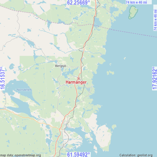
Harmånger GPS coordinates[2]
61° 55' 39.36" North, 17° 13' 6.564" East
| Map corner | latitude | longitude |
|---|---|---|
| Upper-left | 62.25669°, | 16.51537° |
| Center: | 61.9276°, | 17.21849° |
| Lower-right: | 61.59492°, | 17.92162° |
| Map W x H: | 73.6×73.6 km | = 45.7×45.7mi |
| max Lat: | 67.85572° ⇑14.7% North |
| Harmånger: | 61.9276° |
| min Lat: | ⇓85.3% South 55.34337° |
| min Long | Harmånger | max Long |
| 11.1712° | 17.21849° | 24.13676° |
| W 76.8%⇐ | ⇒23.2% E |
Elevation
Elevation of Harmånger is 14 m = 46 ft, and this is 68.6 m = 225 ft below average elevation for this country.
| Max E: |
663 m = 2175 ft | 82.7% |
| Avg. | 82.6 m = 271 ft | |
| Harmånger | 14 m = 46 ft | |
Min E: |
-1 m = -3 ft | 17.3% |
See also: Sweden elevation on elevation.city.
Geographical zone
Harmånger is located in North temperate zone (between Tropic of Cancer and the Arctic Circle). Distance of this North polar circle is 515.5 km =320.3 mi to North.| Distance of | km | miles | from Harmånger |
|---|---|---|---|
| North Pole | 3121.4 | 1939.5 | to North |
| Arctic Circle | 515.5 | 320.3 | to North |
| Tropic Cancer | 4279.8 | 2659.3 | to South |
| Equator | 6885.7 | 4278.6 | to South |


Nearby cities:
15 places around Harmånger: (largest is in red/bold)
• Bergsjö
10.1 km =6.3 mi,  307°
307°
• Delsbo
37.5 km =23.3 mi,  247°
247°
• Dingersjö
39.5 km =24.5 mi,  12°
12°
• Friggesund
35.2 km =21.9 mi,  264°
264°
• Gnarp
13.6 km =8.5 mi, 8°
• Hudiksvall
23 km =14.3 mi,  194°
194°
• Iggesund
32.6 km =20.3 mi, 193°
• Kvissleby
41.5 km =25.8 mi, 11°
• Njurundabommen
38.3 km =23.8 mi, 12°
• Njutånger
36.1 km =22.4 mi, 193°
• Nolby
40.8 km =25.4 mi, 11°
• Näsviken
25.7 km =16 mi,  225°
225°
• Skottsund
41.3 km =25.7 mi, 12°
• Sörforsa
24.9 km =15.5 mi,  209°
209°
• Vi
41.5 km =25.8 mi,  356°
356°
Sources, notices
• [Note1] Compared only with cities in Sweden existing in our database
• [Src1] Map data: © OpenStreetMap contributors (CC-BY-SA)
• [Src2] Other city data from geonames.org with taken over terms of usage.
• [Src3] Geographical zone / Annual Mean Temperature by Robert A. Rohde @ Wikipedia
