Gullbranna geodata
Gullbranna (Halland) is a populated place; located in Sweden in Europe/Stockholm (GMT+2) time zone. With population of 667 people, there are 1100 cities with bigger population in this country. Compared to other cities in Sweden, 82.7% of cities are located further ↑North; 81.4% of cities are located further →East and 91.5% of cities have higher elevation than Gullbranna. Note1


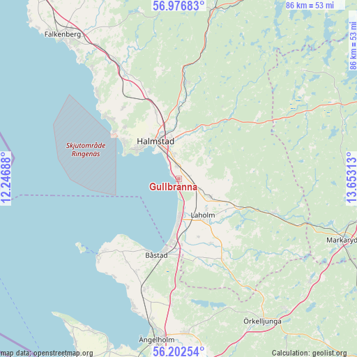
Gullbranna GPS coordinates[2]
56° 35' 30.012" North, 12° 57' 0" East
| Map corner | latitude | longitude |
|---|---|---|
| Upper-left | 56.97683°, | 12.24688° |
| Center: | 56.59167°, | 12.95° |
| Lower-right: | 56.20254°, | 13.65313° |
| Map W x H: | 86.1×86.1 km | = 53.5×53.5mi |
| max Lat: | 67.85572° ⇑82.7% North |
| Gullbranna: | 56.59167° |
| min Lat: | ⇓17.3% South 55.34337° |
| min Long | Gullbranna | max Long |
| 11.1712° | 12.95° | 24.13676° |
| W 18.6%⇐ | ⇒81.4% E |
Elevation
Elevation of Gullbranna is 8 m = 26 ft, and this is 74.6 m = 245 ft below average elevation for this country.
| Max E: |
663 m = 2175 ft | 91.5% |
| Avg. | 82.6 m = 271 ft | |
| Gullbranna | 8 m = 26 ft | |
Min E: |
-1 m = -3 ft | 8.5% |
See also: Sweden elevation on elevation.city.
Geographical zone
Gullbranna is located in North temperate zone (between Tropic of Cancer and the Arctic Circle). Distance of this North polar circle is 1108.8 km =689 mi to North.| Distance of | km | miles | from Gullbranna |
|---|---|---|---|
| North Pole | 3714.7 | 2308.2 | to North |
| Arctic Circle | 1108.8 | 689 | to North |
| Tropic Cancer | 3686.5 | 2290.7 | to South |
| Equator | 6292.4 | 3909.9 | to South |


Nearby cities:
15 places around Gullbranna: (largest is in red/bold)
• Eldsberga
3.2 km =2 mi,  73°
73°
• Frösakull
16.7 km =10.4 mi,  307°
307°
• Fyllinge
6.8 km =4.2 mi,  342°
342°
• Genevad
5.6 km =3.5 mi,  117°
117°
• Halmstad
10.8 km =6.7 mi,  328°
328°
• Holm
17.4 km =10.8 mi, 340°
• Laholm
10.6 km =6.6 mi,  147°
147°
• Lilla Tjärby
9.7 km =6 mi,  137°
137°
• Mellbystrand
11.8 km =7.3 mi,  183°
183°
• Mjällby
15.2 km =9.4 mi, 312°
• Skottorp
15.8 km =9.8 mi, 177°
• Trönninge
3 km =1.9 mi, 339°
• Vallberga
14.5 km =9 mi,  163°
163°
• Veinge
8.5 km =5.3 mi, 122°
• Åled
17.6 km =10.9 mi,  356°
356°
Sources, notices
• [Note1] Compared only with cities in Sweden existing in our database
• [Src1] Map data: © OpenStreetMap contributors (CC-BY-SA)
• [Src2] Other city data from geonames.org with taken over terms of usage.
• [Src3] Geographical zone / Annual Mean Temperature by Robert A. Rohde @ Wikipedia
