Edsbyn geodata
Edsbyn (Gävleborg) is a seat of a second-order administrative division; located in Sweden in Europe/Stockholm (GMT+2) time zone. With population of 4,179 people, there are 313 cities with bigger population in this country. Compared to other cities in Sweden, 84.1% of cities are located further ↓South; 59.5% of cities are located further ←West and 82.3% of cities have lower elevation than Edsbyn. Note1


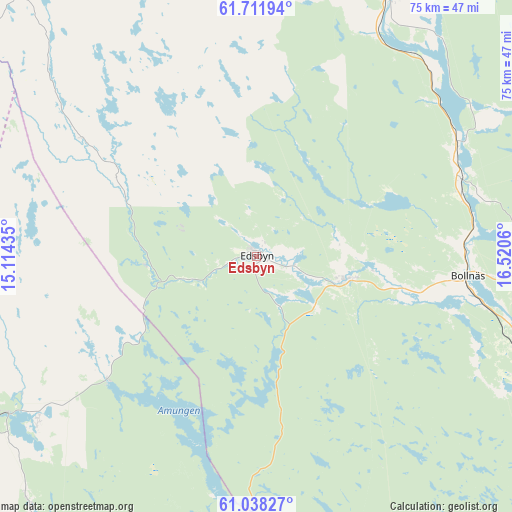
Edsbyn GPS coordinates[2]
61° 22' 36.912" North, 15° 49' 2.892" East
| Map corner | latitude | longitude |
|---|---|---|
| Upper-left | 61.71194°, | 15.11435° |
| Center: | 61.37692°, | 15.81747° |
| Lower-right: | 61.03827°, | 16.5206° |
| Map W x H: | 74.9×74.9 km | = 46.5×46.5mi |
| max Lat: | 67.85572° ⇑15.9% North |
| Edsbyn: | 61.37692° |
| min Lat: | ⇓84.1% South 55.34337° |
| min Long | Edsbyn | max Long |
| 11.1712° | 15.81747° | 24.13676° |
| W 59.5%⇐ | ⇒40.5% E |
Elevation
Elevation of Edsbyn is 155 m = 509 ft, and this is 72.4 m = 238 ft above average elevation for this country.
| Max E: |
663 m = 2175 ft | 17.7% |
| Edsbyn | 155 m 509 ft | |
| Avg. | 82.6 m = 271 ft | |
Min E: |
-1 m = -3 ft | 82.3% |
See also: Sweden elevation on elevation.city.
Geographical zone
Edsbyn is located in North temperate zone (between Tropic of Cancer and the Arctic Circle). Distance of this North polar circle is 576.7 km =358.3 mi to North.| Distance of | km | miles | from Edsbyn |
|---|---|---|---|
| North Pole | 3182.6 | 1977.6 | to North |
| Arctic Circle | 576.7 | 358.3 | to North |
| Tropic Cancer | 4218.6 | 2621.3 | to South |
| Equator | 6824.5 | 4240.5 | to South |


Nearby cities:
15 places around Edsbyn: (largest is in red/bold)
• Alfta
14.1 km =8.8 mi,  103°
103°
• Arbrå
31.7 km =19.7 mi,  71°
71°
• Backa
63.5 km =39.5 mi,  217°
217°
• Bergvik
55.6 km =34.5 mi, 104°
• Boda
51.4 km =31.9 mi, 218°
• Bollnäs
30.9 km =19.2 mi, 95°
• Delsbo
61.2 km =38 mi,  39°
39°
• Enviken
64.2 km =39.9 mi,  181°
181°
• Färila
47.1 km =29.3 mi,  1°
1°
• Järvsö
42.1 km =26.2 mi,  26°
26°
• Kilafors
43.1 km =26.8 mi,  111°
111°
• Ljusdal
52.3 km =32.5 mi,  16°
16°
• Mohed
53.9 km =33.5 mi, 99°
• Söderala
62.2 km =38.6 mi, 99°
• Tallåsen
55.5 km =34.5 mi,  10°
10°
Sources, notices
• [Note1] Compared only with cities in Sweden existing in our database
• [Src1] Map data: © OpenStreetMap contributors (CC-BY-SA)
• [Src2] Other city data from geonames.org with taken over terms of usage.
• [Src3] Geographical zone / Annual Mean Temperature by Robert A. Rohde @ Wikipedia
