Vidsel geodata
Vidsel (Norrbotten) is a populated place; located in Sweden in Europe/Stockholm (GMT+2) time zone. With population of 526 people, there are 1279 cities with bigger population in this country. Compared to other cities in Sweden, 98.2% of cities are located further ↓South; 95.2% of cities are located further ←West and 68.5% of cities have lower elevation than Vidsel. Note1


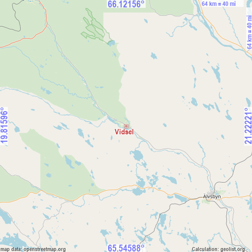
Vidsel GPS coordinates[2]
65° 50' 7.188" North, 20° 31' 8.688" East
| Map corner | latitude | longitude |
|---|---|---|
| Upper-left | 66.12156°, | 19.81596° |
| Center: | 65.83533°, | 20.51908° |
| Lower-right: | 65.54588°, | 21.22221° |
| Map W x H: | 64×64 km | = 39.8×39.8mi |
| max Lat: | 67.85572° ⇑1.8% North |
| Vidsel: | 65.83533° |
| min Lat: | ⇓98.2% South 55.34337° |
| min Long | Vidsel | max Long |
| 11.1712° | 20.51908° | 24.13676° |
| W 95.2%⇐ | ⇒4.8% E |
Elevation
Elevation of Vidsel is 94 m = 308 ft, and this is 11.4 m = 37 ft above average elevation for this country.
| Max E: |
663 m = 2175 ft | 31.5% |
| Vidsel | 94 m 308 ft | |
| Avg. | 82.6 m = 271 ft | |
Min E: |
-1 m = -3 ft | 68.5% |
See also: Sweden elevation on elevation.city.
Geographical zone
Vidsel is located in North temperate zone (between Tropic of Cancer and the Arctic Circle). Distance of this North polar circle is 81 km =50.3 mi to North.| Distance of | km | miles | from Vidsel |
|---|---|---|---|
| North Pole | 2686.9 | 1669.6 | to North |
| Arctic Circle | 81 | 50.3 | to North |
| Tropic Cancer | 4714.3 | 2929.3 | to South |
| Equator | 7320.2 | 4548.6 | to South |


Nearby cities:
15 places around Vidsel: (largest is in red/bold)
• Alvik
67.2 km =41.8 mi,  121°
121°
• Antnäs
67.8 km =42.1 mi, 117°
• Arvidsjaur
67.6 km =42 mi,  246°
246°
• Bergsviken
71.6 km =44.5 mi,  146°
146°
• Boden
53.3 km =33.1 mi,  91°
91°
• Gammelstad
71.6 km =44.5 mi,  107°
107°
• Måttsund
70.7 km =43.9 mi, 116°
• Norrfjärden
64.7 km =40.2 mi,  135°
135°
• Roknäs
62.4 km =38.8 mi, 149°
• Rosvik
70.2 km =43.6 mi,  129°
129°
• Sävast
55.7 km =34.6 mi,  97°
97°
• Södra Sunderbyn
67.8 km =42.1 mi, 106°
• Vuollerim
66.3 km =41.2 mi,  4°
4°
• Älvsbyn
28.3 km =17.6 mi, 128°
• Ånäset
46 km =28.6 mi,  158°
158°
Sources, notices
• [Note1] Compared only with cities in Sweden existing in our database
• [Src1] Map data: © OpenStreetMap contributors (CC-BY-SA)
• [Src2] Other city data from geonames.org with taken over terms of usage.
• [Src3] Geographical zone / Annual Mean Temperature by Robert A. Rohde @ Wikipedia
