Älvsbyn geodata
Älvsbyn (Norrbotten) is a seat of a second-order administrative division; located in Sweden in Europe/Stockholm (GMT+2) time zone. With population of 4,976 people, there are 276 cities with bigger population in this country. Compared to other cities in Sweden, 97.9% of cities are located further ↓South; 96.7% of cities are located further ←West and 62.2% of cities have higher elevation than Älvsbyn. Note1


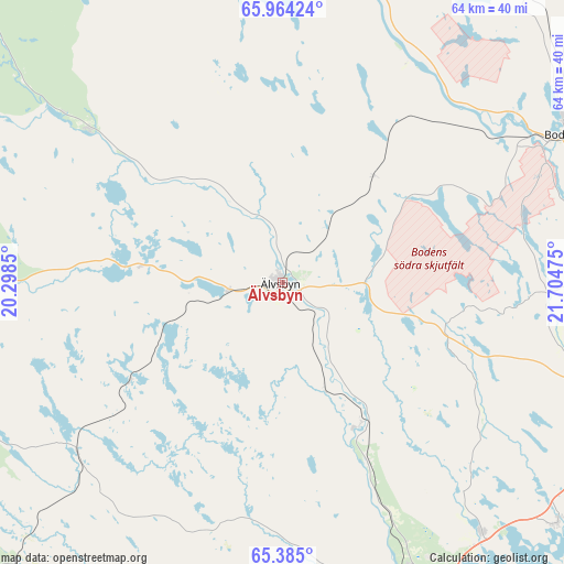
Älvsbyn GPS coordinates[2]
65° 40' 34.464" North, 21° 0' 5.832" East
| Map corner | latitude | longitude |
|---|---|---|
| Upper-left | 65.96424°, | 20.2985° |
| Center: | 65.67624°, | 21.00162° |
| Lower-right: | 65.385°, | 21.70475° |
| Map W x H: | 64.4×64.4 km | = 40×40mi |
| max Lat: | 67.85572° ⇑2.1% North |
| Älvsbyn: | 65.67624° |
| min Lat: | ⇓97.9% South 55.34337° |
| min Long | Älvsbyn | max Long |
| 11.1712° | 21.00162° | 24.13676° |
| W 96.7%⇐ | ⇒3.3% E |
Elevation
Elevation of Älvsbyn is 33 m = 108 ft, and this is 49.6 m = 163 ft below average elevation for this country.
| Max E: |
663 m = 2175 ft | 62.2% |
| Avg. | 82.6 m = 271 ft | |
| Älvsbyn | 33 m = 108 ft | |
Min E: |
-1 m = -3 ft | 37.8% |
See also: Sweden elevation on elevation.city.
Geographical zone
Älvsbyn is located in North temperate zone (between Tropic of Cancer and the Arctic Circle). Distance of this North polar circle is 98.7 km =61.3 mi to North.| Distance of | km | miles | from Älvsbyn |
|---|---|---|---|
| North Pole | 2704.5 | 1680.5 | to North |
| Arctic Circle | 98.7 | 61.3 | to North |
| Tropic Cancer | 4696.6 | 2918.3 | to South |
| Equator | 7302.5 | 4537.6 | to South |


Nearby cities:
15 places around Älvsbyn: (largest is in red/bold)
• Alvik
39.4 km =24.5 mi,  116°
116°
• Antnäs
40.6 km =25.2 mi,  109°
109°
• Bergsviken
45.4 km =28.2 mi,  157°
157°
• Boden
35.5 km =22.1 mi,  62°
62°
• Gammelstad
46.5 km =28.9 mi,  95°
95°
• Hortlax
47.6 km =29.6 mi, 156°
• Måttsund
43.6 km =27.1 mi, 108°
• Norrfjärden
36.8 km =22.9 mi,  141°
141°
• Piteå
45.6 km =28.3 mi,  151°
151°
• Roknäs
37.4 km =23.2 mi,  165°
165°
• Rosvik
42 km =26.1 mi,  130°
130°
• Sävast
34.9 km =21.7 mi,  72°
72°
• Södra Sunderbyn
43 km =26.7 mi,  92°
92°
• Vidsel
28.3 km =17.6 mi,  308°
308°
• Ånäset
25.7 km =16 mi,  192°
192°
Sources, notices
• [Note1] Compared only with cities in Sweden existing in our database
• [Src1] Map data: © OpenStreetMap contributors (CC-BY-SA)
• [Src2] Other city data from geonames.org with taken over terms of usage.
• [Src3] Geographical zone / Annual Mean Temperature by Robert A. Rohde @ Wikipedia
