Arvidsjaur geodata
Arvidsjaur (Norrbotten) is a seat of a second-order administrative division; located in Sweden in Europe/Stockholm (GMT+2) time zone. With population of 4,655 people, there are 292 cities with bigger population in this country. Compared to other cities in Sweden, 97.3% of cities are located further ↓South; 93.1% of cities are located further ←West and 98.8% of cities have lower elevation than Arvidsjaur. Note1


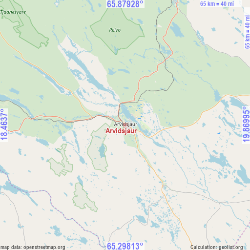
Arvidsjaur GPS coordinates[2]
65° 35' 25.188" North, 19° 10' 0.552" East
| Map corner | latitude | longitude |
|---|---|---|
| Upper-left | 65.87928°, | 18.4637° |
| Center: | 65.59033°, | 19.16682° |
| Lower-right: | 65.29813°, | 19.86995° |
| Map W x H: | 64.6×64.6 km | = 40.1×40.1mi |
| max Lat: | 67.85572° ⇑2.7% North |
| Arvidsjaur: | 65.59033° |
| min Lat: | ⇓97.3% South 55.34337° |
| min Long | Arvidsjaur | max Long |
| 11.1712° | 19.16682° | 24.13676° |
| W 93.1%⇐ | ⇒6.9% E |
Elevation
Elevation of Arvidsjaur is 380 m = 1247 ft, and this is 297.4 m = 976 ft above average elevation for this country.
| Max E: |
663 m = 2175 ft | 1.2% |
| Arvidsjaur | 380 m 1247 ft | |
| Avg. | 82.6 m = 271 ft | |
Min E: |
-1 m = -3 ft | 98.8% |
See also: Sweden elevation on elevation.city.
Geographical zone
Arvidsjaur is located in North temperate zone (between Tropic of Cancer and the Arctic Circle). Distance of this North polar circle is 108.2 km =67.2 mi to North.| Distance of | km | miles | from Arvidsjaur |
|---|---|---|---|
| North Pole | 2714.1 | 1686.5 | to North |
| Arctic Circle | 108.2 | 67.2 | to North |
| Tropic Cancer | 4687 | 2912.4 | to South |
| Equator | 7293 | 4531.7 | to South |


Nearby cities:
15 places around Arvidsjaur: (largest is in red/bold)
• Arjeplog
77.7 km =48.3 mi,  311°
311°
• Boliden
98.4 km =61.1 mi,  144°
144°
• Guojkkasuoluoj
49.4 km =30.7 mi,  277°
277°
• Jörn
71.6 km =44.5 mi,  145°
145°
• Långsele
99.8 km =62 mi, 149°
• Malå
49.2 km =30.6 mi,  203°
203°
• Norsjö
76.8 km =47.7 mi,  169°
169°
• Roknäs
97.6 km =60.6 mi,  105°
105°
• Sorsele
75.2 km =46.7 mi,  265°
265°
• Storvik
87.6 km =54.4 mi,  123°
123°
• Svartå
96.7 km =60.1 mi,  129°
129°
• Vidsel
67.6 km =42 mi,  66°
66°
• Älvsbyn
84.7 km =52.6 mi,  83°
83°
• Ånäset
80.6 km =50.1 mi,  101°
101°
• Östansjö
93.3 km =58 mi, 306°
Sources, notices
• [Note1] Compared only with cities in Sweden existing in our database
• [Src1] Map data: © OpenStreetMap contributors (CC-BY-SA)
• [Src2] Other city data from geonames.org with taken over terms of usage.
• [Src3] Geographical zone / Annual Mean Temperature by Robert A. Rohde @ Wikipedia
