Långsele geodata
Långsele (Västerbotten) is a populated place; located in Sweden in Europe/Stockholm (GMT+2) time zone. With population of 1,620 people, there are 614 cities with bigger population in this country. Compared to other cities in Sweden, 94.9% of cities are located further ↓South; 94.4% of cities are located further ←West and 89.1% of cities have lower elevation than Långsele. Note1


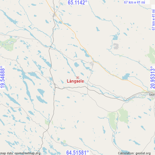
Långsele GPS coordinates[2]
64° 49' 0.012" North, 20° 15' 0" East
| Map corner | latitude | longitude |
|---|---|---|
| Upper-left | 65.1142°, | 19.54688° |
| Center: | 64.81667°, | 20.25° |
| Lower-right: | 64.51581°, | 20.95313° |
| Map W x H: | 66.5×66.5 km | = 41.3×41.3mi |
| max Lat: | 67.85572° ⇑5.1% North |
| Långsele: | 64.81667° |
| min Lat: | ⇓94.9% South 55.34337° |
| min Long | Långsele | max Long |
| 11.1712° | 20.25° | 24.13676° |
| W 94.4%⇐ | ⇒5.6% E |
Elevation
Elevation of Långsele is 193 m = 633 ft, and this is 110.4 m = 362 ft above average elevation for this country.
| Max E: |
663 m = 2175 ft | 10.9% |
| Långsele | 193 m 633 ft | |
| Avg. | 82.6 m = 271 ft | |
Min E: |
-1 m = -3 ft | 89.1% |
See also: Sweden elevation on elevation.city.
Geographical zone
Långsele is located in North temperate zone (between Tropic of Cancer and the Arctic Circle). Distance of this North polar circle is 194.2 km =120.7 mi to North.| Distance of | km | miles | from Långsele |
|---|---|---|---|
| North Pole | 2800.1 | 1739.9 | to North |
| Arctic Circle | 194.2 | 120.7 | to North |
| Tropic Cancer | 4601 | 2858.9 | to South |
| Equator | 7206.9 | 4478.2 | to South |


Nearby cities:
15 places around Långsele: (largest is in red/bold)
• Backa
42.7 km =26.5 mi,  64°
64°
• Boliden
8.4 km =5.2 mi,  48°
48°
• Burträsk
38.4 km =23.9 mi,  150°
150°
• Ersmark
30.7 km =19.1 mi,  83°
83°
• Forsbacka
13.1 km =8.1 mi,  115°
115°
• Jörn
28.7 km =17.8 mi,  339°
339°
• Kåge
34.8 km =21.6 mi,  86°
86°
• Medle
24.5 km =15.2 mi,  110°
110°
• Norsjö
37.8 km =23.5 mi,  286°
286°
• Nyland
24.4 km =15.2 mi, 90°
• Ostvik
39.3 km =24.4 mi, 79°
• Skellefteå
34.1 km =21.2 mi,  102°
102°
• Svartå
34.3 km =21.3 mi, 45°
• Tällberg
31.9 km =19.8 mi, 54°
• Viken
33.1 km =20.6 mi, 107°
Sources, notices
• [Note1] Compared only with cities in Sweden existing in our database
• [Src1] Map data: © OpenStreetMap contributors (CC-BY-SA)
• [Src2] Other city data from geonames.org with taken over terms of usage.
• [Src3] Geographical zone / Annual Mean Temperature by Robert A. Rohde @ Wikipedia
