Šentilj v Slov. Goricah geodata
Šentilj v Slov. Goricah (Šentilj) is a seat of a first-order administrative division; located in Slovenia in Europe/Ljubljana (GMT+2) time zone. With population of 1,826 people, there are 112 cities with bigger population in this country. Compared to other cities in Slovenia, 97.3% of cities are located further ↓South; 75.5% of cities are located further ←West and 53.3% of cities have lower elevation than Šentilj v Slov. Goricah. Note1
Current local time in Šentilj v Slov. Goricah:
05:36 AM, MondayDifference from your time zone: hours


Šentilj v Slov. Goricah GPS coordinates[2]
46° 40' 54.012" North, 15° 38' 53.016" East
| Map corner | latitude | longitude |
|---|---|---|
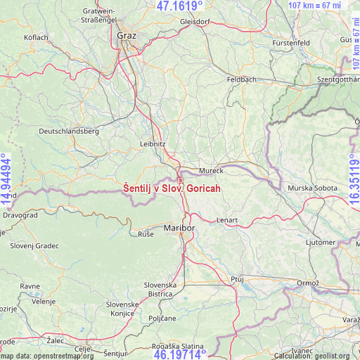
| Upper-left | 47.1619°, | 14.94494° |
| Center: | 46.68167°, | 15.64806° |
| Lower-right: | 46.19714°, | 16.35119° |
| Map W x H: | 107.3×107.3 km | = 66.7×66.7mi |
| max Lat: | 46.83694° ⇑2.7% North |
| Šentilj v Slov. Goricah: | 46.68167° |
| min Lat: | ⇓97.3% South 45.47667° |
| min Long | Šentilj v Slov | max Long |
| 13.52639° | 15.64806° | 16.4975° |
| W 75.5%⇐ | ⇒24.5% E |
Elevation
Elevation of Šentilj v Slov. Goricah is 306 m = 1004 ft, and this is 19.6 m = 64 ft below average elevation for this country.
| Max E: |
1551 m = 5089 ft | 46.7% |
| Avg. | 325.6 m = 1068 ft | |
| Šentilj v Slov. Goricah | 306 m = 1004 ft | |
Min E: |
2 m = 7 ft | 53.3% |
See also: Slovenia elevation on elevation.city.
Geographical zone
Šentilj v Slov. Goricah is located in North temperate zone (between Tropic of Cancer and the Arctic Circle). Distance of this North polar circle is 2210.7 km =1373.7 mi to North.| Distance of | km | miles | from Šentilj v Slov. Goricah |
|---|---|---|---|
| North Pole | 4816.5 | 2992.8 | to North |
| Arctic Circle | 2210.7 | 1373.7 | to North |
| Tropic Cancer | 2584.6 | 1606 | to South |
| Equator | 5190.5 | 3225.2 | to South |


Nearby cities:
15 places around Šentilj v Slov. Goricah: (largest is in red/bold)
• Bresternica
13.6 km =8.5 mi,  204°
204°
• Ceršak
2.5 km =1.6 mi,  39°
39°
• Gačnik
8.2 km =5.1 mi,  151°
151°
• Gradiška
7.2 km =4.5 mi,  180°
180°
• Jurovski Dol
13.4 km =8.3 mi,  128°
128°
• Kamnica
12.2 km =7.6 mi,  192°
192°
• Kozjak nad Pesnico
8 km =5 mi, 187°
• Maribor
14.1 km =8.8 mi, 180°
• Pesnica pri Mariboru
8.6 km =5.3 mi,  165°
165°
• Plintovec
5.4 km =3.4 mi, 204°
• Selnica ob Muri
4 km =2.5 mi,  87°
87°
• Sladki Vrh
6.8 km =4.2 mi,  83°
83°
• Zgornja Kungota
5.3 km =3.3 mi,  207°
207°
• Zgornja Velka
9.3 km =5.8 mi, 94°
• Zgornje Partinje
12.8 km =8 mi,  138°
138°
Sources, notices
• [Note1] Compared only with cities in Slovenia existing in our database
• [Src1] Map data: © OpenStreetMap contributors (CC-BY-SA)
• [Src2] Other city data from geonames.org with taken over terms of usage.
• [Src3] Geographical zone / Annual Mean Temperature by Robert A. Rohde @ Wikipedia
