Šenčur geodata
Šenčur is a seat of a first-order administrative division; located in Slovenia in Europe/Ljubljana (GMT+2) time zone. With population of 3,152 people, there are 65 cities with bigger population in this country. Compared to other cities in Slovenia, 52.2% of cities are located further ↑North; 69.3% of cities are located further →East and 75.5% of cities have lower elevation than Šenčur. Note1


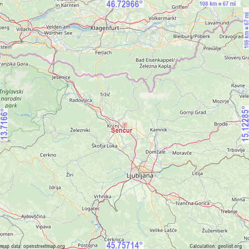
Šenčur GPS coordinates[2]
46° 14' 44.016" North, 14° 25' 10.992" East
| Map corner | latitude | longitude |
|---|---|---|
| Upper-left | 46.72966°, | 13.7166° |
| Center: | 46.24556°, | 14.41972° |
| Lower-right: | 45.75714°, | 15.12285° |
| Map W x H: | 108.1×108.1 km | = 67.2×67.2mi |
| max Lat: | 46.83694° ⇑52.2% North |
| Šenčur: | 46.24556° |
| min Lat: | ⇓47.8% South 45.47667° |
| min Long | Šenčur | max Long |
| 13.52639° | 14.41972° | 16.4975° |
| W 30.7%⇐ | ⇒69.3% E |
Elevation
Elevation of Šenčur is 408 m = 1339 ft, and this is 82.4 m = 270 ft above average elevation for this country.
| Max E: |
1551 m = 5089 ft | 24.5% |
| Šenčur | 408 m 1339 ft | |
| Avg. | 325.6 m = 1068 ft | |
Min E: |
2 m = 7 ft | 75.5% |
See also: Slovenia elevation on elevation.city.
Geographical zone
Šenčur is located in North temperate zone (between Tropic of Cancer and the Arctic Circle). Distance of this North polar circle is 2259.1 km =1403.7 mi to North.| Distance of | km | miles | from Šenčur |
|---|---|---|---|
| North Pole | 4865 | 3023 | to North |
| Arctic Circle | 2259.1 | 1403.7 | to North |
| Tropic Cancer | 2536.1 | 1575.9 | to South |
| Equator | 5142 | 3195.1 | to South |


Nearby cities:
15 places around Šenčur: (largest is in red/bold)
• Britof
2.8 km =1.7 mi,  305°
305°
• Cerklje na Gorenjskem
5.4 km =3.4 mi,  79°
79°
• Hotemaže
4 km =2.5 mi,  1°
1°
• Hrastje
3.6 km =2.2 mi,  205°
205°
• Kokrica
5.3 km =3.3 mi,  301°
301°
• Kranj
5 km =3.1 mi,  261°
261°
• Mlaka pri Kranju
6.8 km =4.2 mi, 308°
• Preddvor
6.3 km =3.9 mi, 2°
• Predoslje
3.4 km =2.1 mi, 311°
• Trboje
5.1 km =3.2 mi,  182°
182°
• Visoko
2.8 km =1.7 mi,  357°
357°
• Voglje
3.6 km =2.2 mi,  156°
156°
• Voklo
3.3 km =2.1 mi, 175°
• Zgornje Bitnje
7 km =4.3 mi,  246°
246°
• Zgornji Brnik
5 km =3.1 mi,  98°
98°
Sources, notices
• [Note1] Compared only with cities in Slovenia existing in our database
• [Src1] Map data: © OpenStreetMap contributors (CC-BY-SA)
• [Src2] Other city data from geonames.org with taken over terms of usage.
• [Src3] Geographical zone / Annual Mean Temperature by Robert A. Rohde @ Wikipedia
