Hotemaže geodata
Hotemaže (Šenčur) is a populated place; located in Slovenia in Europe/Ljubljana (GMT+2) time zone. With population of 512 people, there are 539 cities with bigger population in this country. Compared to other cities in Slovenia, 52.5% of cities are located further ↓South; 69.2% of cities are located further →East and 81.2% of cities have lower elevation than Hotemaže. Note1


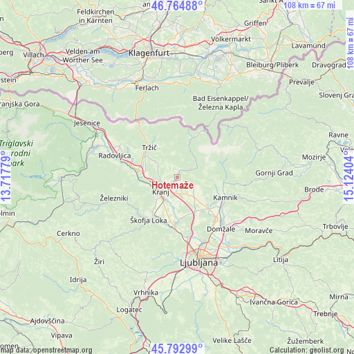
Hotemaže GPS coordinates[2]
46° 16' 51.924" North, 14° 25' 15.276" East
| Map corner | latitude | longitude |
|---|---|---|
| Upper-left | 46.76488°, | 13.71779° |
| Center: | 46.28109°, | 14.42091° |
| Lower-right: | 45.79299°, | 15.12404° |
| Map W x H: | 108.1×108.1 km | = 67.2×67.2mi |
| max Lat: | 46.83694° ⇑47.5% North |
| Hotemaže: | 46.28109° |
| min Lat: | ⇓52.5% South 45.47667° |
| min Long | Hotemaže | max Long |
| 13.52639° | 14.42091° | 16.4975° |
| W 30.8%⇐ | ⇒69.2% E |
Elevation
Elevation of Hotemaže is 440 m = 1444 ft, and this is 114.4 m = 375 ft above average elevation for this country.
| Max E: |
1551 m = 5089 ft | 18.8% |
| Hotemaže | 440 m 1444 ft | |
| Avg. | 325.6 m = 1068 ft | |
Min E: |
2 m = 7 ft | 81.2% |
See also: Slovenia elevation on elevation.city.
Geographical zone
Hotemaže is located in North temperate zone (between Tropic of Cancer and the Arctic Circle). Distance of this North polar circle is 2255.2 km =1401.3 mi to North.| Distance of | km | miles | from Hotemaže |
|---|---|---|---|
| North Pole | 4861.1 | 3020.5 | to North |
| Arctic Circle | 2255.2 | 1401.3 | to North |
| Tropic Cancer | 2540.1 | 1578.3 | to South |
| Equator | 5146 | 3197.6 | to South |


Nearby cities:
15 places around Hotemaže: (largest is in red/bold)
• Britof
3.3 km =2.1 mi,  225°
225°
• Cerklje na Gorenjskem
6 km =3.7 mi,  119°
119°
• Hrastje
7.3 km =4.5 mi,  192°
192°
• Kokrica
4.8 km =3 mi,  255°
255°
• Kranj
6.9 km =4.3 mi, 226°
• Mlaka pri Kranju
5.5 km =3.4 mi,  272°
272°
• Naklo
8 km =5 mi, 263°
• Preddvor
2.4 km =1.5 mi,  3°
3°
• Predoslje
3.2 km =2 mi,  237°
237°
• Strahinj
8 km =5 mi, 271°
• Visoko
1.1 km =0.7 mi, 191°
• Voglje
7.4 km =4.6 mi,  169°
169°
• Voklo
7.2 km =4.5 mi,  178°
178°
• Zgornji Brnik
6.8 km =4.2 mi,  133°
133°
• Šenčur
4 km =2.5 mi, 181°
Sources, notices
• [Note1] Compared only with cities in Slovenia existing in our database
• [Src1] Map data: © OpenStreetMap contributors (CC-BY-SA)
• [Src2] Other city data from geonames.org with taken over terms of usage.
• [Src3] Geographical zone / Annual Mean Temperature by Robert A. Rohde @ Wikipedia
