Lokev geodata
Lokev (Sežana) is a populated place; located in Slovenia in Europe/Ljubljana (GMT+2) time zone. With population of 780 people, there are 312 cities with bigger population in this country. Compared to other cities in Slovenia, 92% of cities are located further ↑North; 88.3% of cities are located further →East and 83.3% of cities have lower elevation than Lokev. Note1


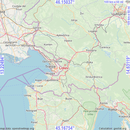
Lokev GPS coordinates[2]
45° 39' 39.996" North, 13° 55' 41.016" East
| Map corner | latitude | longitude |
|---|---|---|
| Upper-left | 46.15037°, | 13.22494° |
| Center: | 45.66111°, | 13.92806° |
| Lower-right: | 45.16754°, | 14.63119° |
| Map W x H: | 109.3×109.3 km | = 67.9×67.9mi |
| max Lat: | 46.83694° ⇑92% North |
| Lokev: | 45.66111° |
| min Lat: | ⇓8% South 45.47667° |
| min Long | Lokev | max Long |
| 13.52639° | 13.92806° | 16.4975° |
| W 11.7%⇐ | ⇒88.3% E |
Elevation
Elevation of Lokev is 453 m = 1486 ft, and this is 127.4 m = 418 ft above average elevation for this country.
| Max E: |
1551 m = 5089 ft | 16.7% |
| Lokev | 453 m 1486 ft | |
| Avg. | 325.6 m = 1068 ft | |
Min E: |
2 m = 7 ft | 83.3% |
See also: Slovenia elevation on elevation.city.
Geographical zone
Lokev is located in North temperate zone (between Tropic of Cancer and the Arctic Circle). Distance of this North polar circle is 2324.1 km =1444.1 mi to North.| Distance of | km | miles | from Lokev |
|---|---|---|---|
| North Pole | 4930 | 3063.4 | to North |
| Arctic Circle | 2324.1 | 1444.1 | to North |
| Tropic Cancer | 2471.1 | 1535.5 | to South |
| Equator | 5077 | 3154.7 | to South |


Nearby cities:
15 places around Lokev: (largest is in red/bold)
• Dekani
15.3 km =9.5 mi,  215°
215°
• Divača
4.2 km =2.6 mi,  51°
51°
• Dutovlje
13.1 km =8.1 mi,  325°
325°
• Hrpelje
6.1 km =3.8 mi,  169°
169°
• Hrvatini
15.9 km =9.9 mi,  236°
236°
• Kolomban
16.1 km =10 mi, 240°
• Kozina
5.7 km =3.5 mi, 174°
• Križ
10.5 km =6.5 mi, 332°
• Pobegi
17 km =10.6 mi, 217°
• Senožeče
11 km =6.8 mi, 52°
• Sežana
6.8 km =4.2 mi,  321°
321°
• Spodnje Škofije
14.5 km =9 mi,  226°
226°
• Sv. Anton
16.8 km =10.4 mi,  206°
206°
• Zgornje Škofije
14.5 km =9 mi, 223°
• Čežarji
16.6 km =10.3 mi, 215°
Sources, notices
• [Note1] Compared only with cities in Slovenia existing in our database
• [Src1] Map data: © OpenStreetMap contributors (CC-BY-SA)
• [Src2] Other city data from geonames.org with taken over terms of usage.
• [Src3] Geographical zone / Annual Mean Temperature by Robert A. Rohde @ Wikipedia
