Dutovlje geodata
Dutovlje (Sežana) is a populated place; located in Slovenia in Europe/Ljubljana (GMT+2) time zone. With population of 715 people, there are 350 cities with bigger population in this country. Compared to other cities in Slovenia, 89.5% of cities are located further ↑North; 90% of cities are located further →East and 52.8% of cities have higher elevation than Dutovlje. Note1


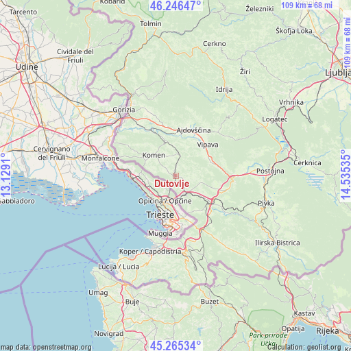
Dutovlje GPS coordinates[2]
45° 45' 29.016" North, 13° 49' 55.992" East
| Map corner | latitude | longitude |
|---|---|---|
| Upper-left | 46.24647°, | 13.1291° |
| Center: | 45.75806°, | 13.83222° |
| Lower-right: | 45.26534°, | 14.53535° |
| Map W x H: | 109.1×109.1 km | = 67.8×67.8mi |
| max Lat: | 46.83694° ⇑89.5% North |
| Dutovlje: | 45.75806° |
| min Lat: | ⇓10.5% South 45.47667° |
| min Long | Dutovlje | max Long |
| 13.52639° | 13.83222° | 16.4975° |
| W 10%⇐ | ⇒90% E |
Elevation
Elevation of Dutovlje is 291 m = 955 ft, and this is 34.6 m = 114 ft below average elevation for this country.
| Max E: |
1551 m = 5089 ft | 52.8% |
| Avg. | 325.6 m = 1068 ft | |
| Dutovlje | 291 m = 955 ft | |
Min E: |
2 m = 7 ft | 47.2% |
See also: Slovenia elevation on elevation.city.
Geographical zone
Dutovlje is located in North temperate zone (between Tropic of Cancer and the Arctic Circle). Distance of this North polar circle is 2313.4 km =1437.5 mi to North.| Distance of | km | miles | from Dutovlje |
|---|---|---|---|
| North Pole | 4919.2 | 3056.6 | to North |
| Arctic Circle | 2313.4 | 1437.5 | to North |
| Tropic Cancer | 2481.9 | 1542.2 | to South |
| Equator | 5087.8 | 3161.4 | to South |


Nearby cities:
15 places around Dutovlje: (largest is in red/bold)
• Ajdovščina
15.4 km =9.6 mi,  22°
22°
• Branik
11.6 km =7.2 mi,  341°
341°
• Budanje
15.8 km =9.8 mi,  34°
34°
• Cesta
14.7 km =9.1 mi,  11°
11°
• Divača
13.5 km =8.4 mi,  127°
127°
• Dornberk
16.4 km =10.2 mi,  333°
333°
• Komen
9.1 km =5.7 mi,  314°
314°
• Križ
3 km =1.9 mi,  119°
119°
• Lokavec
16.4 km =10.2 mi, 12°
• Lokev
13.1 km =8.1 mi,  145°
145°
• Prvačina
17.1 km =10.6 mi, 328°
• Senožeče
16.7 km =10.4 mi,  104°
104°
• Sežana
6.3 km =3.9 mi, 149°
• Vipava
14.1 km =8.8 mi,  45°
45°
• Vrhpolje
15.5 km =9.6 mi,  40°
40°
Sources, notices
• [Note1] Compared only with cities in Slovenia existing in our database
• [Src1] Map data: © OpenStreetMap contributors (CC-BY-SA)
• [Src2] Other city data from geonames.org with taken over terms of usage.
• [Src3] Geographical zone / Annual Mean Temperature by Robert A. Rohde @ Wikipedia
