Ljubečna geodata
Ljubečna (Celje) is a populated place; located in Slovenia in Europe/Ljubljana (GMT+2) time zone. With population of 1,071 people, there are 199 cities with bigger population in this country. Compared to other cities in Slovenia, 51.2% of cities are located further ↑North; 65.7% of cities are located further ←West and 65.2% of cities have higher elevation than Ljubečna. Note1


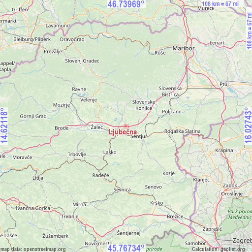
Ljubečna GPS coordinates[2]
46° 15' 20.412" North, 15° 19' 27.48" East
| Map corner | latitude | longitude |
|---|---|---|
| Upper-left | 46.73969°, | 14.62118° |
| Center: | 46.25567°, | 15.3243° |
| Lower-right: | 45.76734°, | 16.02743° |
| Map W x H: | 108.1×108.1 km | = 67.2×67.2mi |
| max Lat: | 46.83694° ⇑51.2% North |
| Ljubečna: | 46.25567° |
| min Lat: | ⇓48.8% South 45.47667° |
| min Long | Ljubečna | max Long |
| 13.52639° | 15.3243° | 16.4975° |
| W 65.7%⇐ | ⇒34.3% E |
Elevation
Elevation of Ljubečna is 259 m = 850 ft, and this is 66.6 m = 219 ft below average elevation for this country.
| Max E: |
1551 m = 5089 ft | 65.2% |
| Avg. | 325.6 m = 1068 ft | |
| Ljubečna | 259 m = 850 ft | |
Min E: |
2 m = 7 ft | 34.8% |
See also: Slovenia elevation on elevation.city.
Geographical zone
Ljubečna is located in North temperate zone (between Tropic of Cancer and the Arctic Circle). Distance of this North polar circle is 2258 km =1403.1 mi to North.| Distance of | km | miles | from Ljubečna |
|---|---|---|---|
| North Pole | 4863.9 | 3022.3 | to North |
| Arctic Circle | 2258 | 1403.1 | to North |
| Tropic Cancer | 2537.2 | 1576.5 | to South |
| Equator | 5143.1 | 3195.8 | to South |


Nearby cities:
15 places around Ljubečna: (largest is in red/bold)
• Arja Vas
10.4 km =6.5 mi,  271°
271°
• Celje
5.6 km =3.5 mi,  240°
240°
• Galicija
11 km =6.8 mi,  296°
296°
• Gorica pri Slivnici
11.3 km =7 mi,  132°
132°
• Gorica pri Šmartnem
7.5 km =4.7 mi,  286°
286°
• Kasaze
9.9 km =6.2 mi,  255°
255°
• Košnica pri Celju
8.2 km =5.1 mi, 238°
• Liboje
11.1 km =6.9 mi, 243°
• Lopata
7.3 km =4.5 mi, 274°
• Petrovče
10.4 km =6.5 mi, 261°
• Trnovlje pri Celju
2.2 km =1.4 mi, 272°
• Vojnik
4.5 km =2.8 mi,  338°
338°
• Zadobrova
1.9 km =1.2 mi,  306°
306°
• Šentjur
7.1 km =4.4 mi, 127°
• Štore
4 km =2.5 mi,  191°
191°
Sources, notices
• [Note1] Compared only with cities in Slovenia existing in our database
• [Src1] Map data: © OpenStreetMap contributors (CC-BY-SA)
• [Src2] Other city data from geonames.org with taken over terms of usage.
• [Src3] Geographical zone / Annual Mean Temperature by Robert A. Rohde @ Wikipedia
