Šentjur geodata
Šentjur (Sentjur) is a seat of a first-order administrative division; located in Slovenia in Europe/Ljubljana (GMT+2) time zone. With population of 4,762 people, there are 41 cities with bigger population in this country. Compared to other cities in Slovenia, 55.8% of cities are located further ↑North; 66.7% of cities are located further ←West and 52% of cities have lower elevation than Šentjur. Note1


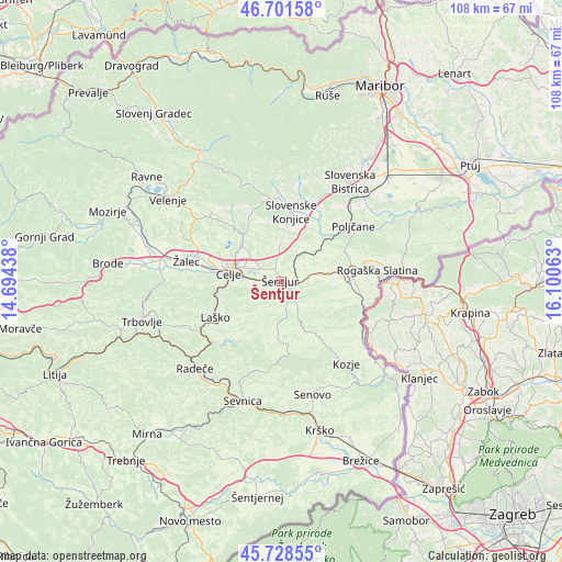
Šentjur GPS coordinates[2]
46° 13' 1.992" North, 15° 23' 51" East
| Map corner | latitude | longitude |
|---|---|---|
| Upper-left | 46.70158°, | 14.69438° |
| Center: | 46.21722°, | 15.3975° |
| Lower-right: | 45.72855°, | 16.10063° |
| Map W x H: | 108.2×108.2 km | = 67.2×67.2mi |
| max Lat: | 46.83694° ⇑55.8% North |
| Šentjur: | 46.21722° |
| min Lat: | ⇓44.2% South 45.47667° |
| min Long | Šentjur | max Long |
| 13.52639° | 15.3975° | 16.4975° |
| W 66.7%⇐ | ⇒33.3% E |
Elevation
Elevation of Šentjur is 301 m = 988 ft, and this is 24.6 m = 81 ft below average elevation for this country.
| Max E: |
1551 m = 5089 ft | 48% |
| Avg. | 325.6 m = 1068 ft | |
| Šentjur | 301 m = 988 ft | |
Min E: |
2 m = 7 ft | 52% |
See also: Slovenia elevation on elevation.city.
Geographical zone
Šentjur is located in North temperate zone (between Tropic of Cancer and the Arctic Circle). Distance of this North polar circle is 2262.3 km =1405.7 mi to North.| Distance of | km | miles | from Šentjur |
|---|---|---|---|
| North Pole | 4868.2 | 3025 | to North |
| Arctic Circle | 2262.3 | 1405.7 | to North |
| Tropic Cancer | 2533 | 1573.9 | to South |
| Equator | 5138.9 | 3193.2 | to South |


Nearby cities:
15 places around Šentjur: (largest is in red/bold)
• Celje
10.7 km =6.6 mi,  278°
278°
• Dobje pri Planini
8.9 km =5.5 mi,  181°
181°
• Gorica pri Slivnici
4.3 km =2.7 mi,  141°
141°
• Košnica pri Celju
12.6 km =7.8 mi,  269°
269°
• Laško
14.3 km =8.9 mi,  240°
240°
• Ljubečna
7.1 km =4.4 mi,  307°
307°
• Lopata
13.8 km =8.6 mi,  290°
290°
• Loče
12.1 km =7.5 mi,  40°
40°
• Slovenske Konjice
13.5 km =8.4 mi,  9°
9°
• Trnovlje pri Celju
9 km =5.6 mi,  299°
299°
• Vojnik
11.1 km =6.9 mi,  319°
319°
• Zadobrova
9 km =5.6 mi, 307°
• Šmarje pri Jelšah
9.4 km =5.8 mi,  83°
83°
• Štore
6.4 km =4 mi, 273°
• Žiče
12.6 km =7.8 mi,  30°
30°
Sources, notices
• [Note1] Compared only with cities in Slovenia existing in our database
• [Src1] Map data: © OpenStreetMap contributors (CC-BY-SA)
• [Src2] Other city data from geonames.org with taken over terms of usage.
• [Src3] Geographical zone / Annual Mean Temperature by Robert A. Rohde @ Wikipedia
