Vojnik geodata
Vojnik is a seat of a first-order administrative division; located in Slovenia in Europe/Ljubljana (GMT+2) time zone. With population of 2,292 people, there are 85 cities with bigger population in this country. Compared to other cities in Slovenia, 53.7% of cities are located further ↓South; 64.8% of cities are located further ←West and 59% of cities have higher elevation than Vojnik. Note1


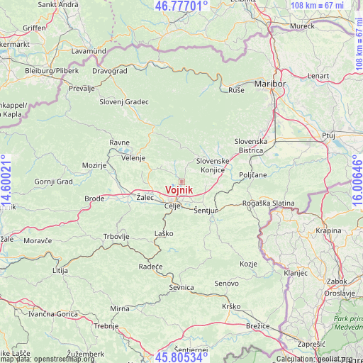
Vojnik GPS coordinates[2]
46° 17' 35.988" North, 15° 18' 11.988" East
| Map corner | latitude | longitude |
|---|---|---|
| Upper-left | 46.77701°, | 14.60021° |
| Center: | 46.29333°, | 15.30333° |
| Lower-right: | 45.80534°, | 16.00646° |
| Map W x H: | 108×108 km | = 67.1×67.1mi |
| max Lat: | 46.83694° ⇑46.3% North |
| Vojnik: | 46.29333° |
| min Lat: | ⇓53.7% South 45.47667° |
| min Long | Vojnik | max Long |
| 13.52639° | 15.30333° | 16.4975° |
| W 64.8%⇐ | ⇒35.2% E |
Elevation
Elevation of Vojnik is 274 m = 899 ft, and this is 51.6 m = 169 ft below average elevation for this country.
| Max E: |
1551 m = 5089 ft | 59% |
| Avg. | 325.6 m = 1068 ft | |
| Vojnik | 274 m = 899 ft | |
Min E: |
2 m = 7 ft | 41% |
See also: Slovenia elevation on elevation.city.
Geographical zone
Vojnik is located in North temperate zone (between Tropic of Cancer and the Arctic Circle). Distance of this North polar circle is 2253.8 km =1400.4 mi to North.| Distance of | km | miles | from Vojnik |
|---|---|---|---|
| North Pole | 4859.7 | 3019.7 | to North |
| Arctic Circle | 2253.8 | 1400.4 | to North |
| Tropic Cancer | 2541.4 | 1579.2 | to South |
| Equator | 5147.3 | 3198.4 | to South |


Nearby cities:
15 places around Vojnik: (largest is in red/bold)
• Arja Vas
9.6 km =6 mi,  246°
246°
• Celje
7.7 km =4.8 mi,  205°
205°
• Dobrna
7.7 km =4.8 mi,  309°
309°
• Galicija
8.3 km =5.2 mi,  274°
274°
• Gorica pri Šmartnem
6 km =3.7 mi, 249°
• Kasaze
10.4 km =6.5 mi,  229°
229°
• Košnica pri Celju
10.1 km =6.3 mi, 212°
• Ljubečna
4.5 km =2.8 mi,  158°
158°
• Lopata
6.8 km =4.2 mi,  237°
237°
• Pernovo
9 km =5.6 mi, 268°
• Petrovče
10.4 km =6.5 mi, 236°
• Trnovlje pri Celju
4.1 km =2.5 mi,  188°
188°
• Vitanje
9.8 km =6.1 mi,  356°
356°
• Zadobrova
3.1 km =1.9 mi,  178°
178°
• Štore
8.1 km =5 mi,  174°
174°
Sources, notices
• [Note1] Compared only with cities in Slovenia existing in our database
• [Src1] Map data: © OpenStreetMap contributors (CC-BY-SA)
• [Src2] Other city data from geonames.org with taken over terms of usage.
• [Src3] Geographical zone / Annual Mean Temperature by Robert A. Rohde @ Wikipedia
