Gozd Martuljek geodata
Gozd Martuljek (Kranjska Gora) is a populated place; located in Slovenia in Europe/Ljubljana (GMT+2) time zone. With population of 631 people, there are 409 cities with bigger population in this country. Compared to other cities in Slovenia, 76.5% of cities are located further ↓South; 89.7% of cities are located further →East and 98.7% of cities have lower elevation than Gozd Martuljek. Note1


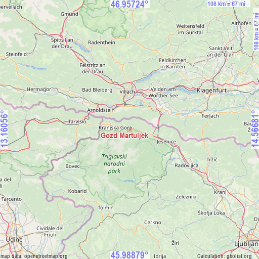
Gozd Martuljek GPS coordinates[2]
46° 28' 30.612" North, 13° 51' 49.248" East
| Map corner | latitude | longitude |
|---|---|---|
| Upper-left | 46.95724°, | 13.16056° |
| Center: | 46.47517°, | 13.86368° |
| Lower-right: | 45.98879°, | 14.56681° |
| Map W x H: | 107.7×107.7 km | = 66.9×66.9mi |
| max Lat: | 46.83694° ⇑23.5% North |
| Gozd Martuljek: | 46.47517° |
| min Lat: | ⇓76.5% South 45.47667° |
| min Long | Gozd Martuljek | max Long |
| 13.52639° | 13.86368° | 16.4975° |
| W 10.3%⇐ | ⇒89.7% E |
Elevation
Elevation of Gozd Martuljek is 838 m = 2749 ft, and this is 512.4 m = 1681 ft above average elevation for this country.
| Max E: |
1551 m = 5089 ft | 1.3% |
| Gozd Martuljek | 838 m 2749 ft | |
| Avg. | 325.6 m = 1068 ft | |
Min E: |
2 m = 7 ft | 98.7% |
See also: Slovenia elevation on elevation.city.
Geographical zone
Gozd Martuljek is located in North temperate zone (between Tropic of Cancer and the Arctic Circle). Distance of this North polar circle is 2233.6 km =1387.9 mi to North.| Distance of | km | miles | from Gozd Martuljek |
|---|---|---|---|
| North Pole | 4839.5 | 3007.1 | to North |
| Arctic Circle | 2233.6 | 1387.9 | to North |
| Tropic Cancer | 2561.6 | 1591.7 | to South |
| Equator | 5167.6 | 3211 | to South |


Nearby cities:
15 places around Gozd Martuljek: (largest is in red/bold)
• Blejska Dobrava
19.9 km =12.4 mi,  114°
114°
• Bohinjska Bela
20.8 km =12.9 mi,  132°
132°
• Dovje
8.3 km =5.2 mi,  95°
95°
• Hrušica
12.3 km =7.6 mi, 105°
• Jesenice
16.3 km =10.1 mi, 107°
• Koroška Bela
19.2 km =11.9 mi, 98°
• Kranjska Gora
6.9 km =4.3 mi,  252°
252°
• Mojstrana
5.8 km =3.6 mi,  171°
171°
• Rateče
11.5 km =7.1 mi,  266°
266°
• Slovenski Javornik
18 km =11.2 mi, 107°
• Spodnje Gorje
14.8 km =9.2 mi,  117°
117°
• Srednja Vas v Bohinju
20.6 km =12.8 mi, 167°
• Stara Fužina
16.8 km =10.4 mi,  184°
184°
• Zasip
20.9 km =13 mi, 115°
• Zgornje Gorje
19 km =11.8 mi, 123°
Sources, notices
• [Note1] Compared only with cities in Slovenia existing in our database
• [Src1] Map data: © OpenStreetMap contributors (CC-BY-SA)
• [Src2] Other city data from geonames.org with taken over terms of usage.
• [Src3] Geographical zone / Annual Mean Temperature by Robert A. Rohde @ Wikipedia
