Svit geodata
Svit (Prešovský kraj) is a populated place; located in Slovakia in Europe/Bratislava (GMT+2) time zone. With population of 7,445 people, there are 89 cities with bigger population in this country. Compared to other cities in Slovakia, 71.2% of cities are located further ↓South; 72.9% of cities are located further ←West and 95.3% of cities have lower elevation than Svit. Note1


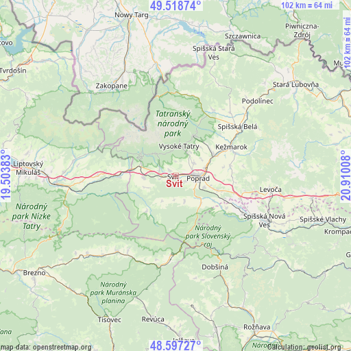
Svit GPS coordinates[2]
49° 3' 36.504" North, 20° 12' 25.02" East
| Map corner | latitude | longitude |
|---|---|---|
| Upper-left | 49.51874°, | 19.50383° |
| Center: | 49.06014°, | 20.20695° |
| Lower-right: | 48.59727°, | 20.91008° |
| Map W x H: | 102.5×102.5 km | = 63.7×63.7mi |
| max Lat: | 49.43503° ⇑28.8% North |
| Svit: | 49.06014° |
| min Lat: | ⇓71.2% South 47.76356° |
| min Long | Svit | max Long |
| 16.9786° | 20.20695° | 22.18136° |
| W 72.9%⇐ | ⇒27.1% E |
Elevation
Elevation of Svit is 723 m = 2372 ft, and this is 386.9 m = 1269 ft above average elevation for this country.
| Max E: |
1006 m = 3301 ft | 4.7% |
| Svit | 723 m 2372 ft | |
| Avg. | 336.1 m = 1103 ft | |
Min E: |
102 m = 335 ft | 95.3% |
See also: Slovakia elevation on elevation.city.
Geographical zone
Svit is located in North temperate zone (between Tropic of Cancer and the Arctic Circle). Distance of this North polar circle is 1946.2 km =1209.3 mi to North.| Distance of | km | miles | from Svit |
|---|---|---|---|
| North Pole | 4552.1 | 2828.5 | to North |
| Arctic Circle | 1946.2 | 1209.3 | to North |
| Tropic Cancer | 2849.1 | 1770.3 | to South |
| Equator | 5455 | 3389.6 | to South |


Nearby cities:
15 places around Svit: (largest is in red/bold)
• Dobšiná
29.2 km =18.1 mi,  155°
155°
• Hybe
27.6 km =17.1 mi,  266°
266°
• Kežmarok
18.5 km =11.5 mi,  63°
63°
• Levoča
28.4 km =17.6 mi,  98°
98°
• Nová Lesná
8.2 km =5.1 mi,  32°
32°
• Poprad
6.6 km =4.1 mi,  88°
88°
• Spišská Belá
23.2 km =14.4 mi,  52°
52°
• Spišská Nová Ves
28.9 km =18 mi,  116°
116°
• Starý Smokovec
8.8 km =5.5 mi,  6°
6°
• Tatranská Lomnica
13 km =8.1 mi,  24°
24°
• Vrbov
16.2 km =10.1 mi,  79°
79°
• Vysoké Tatry
8.9 km =5.5 mi, 17°
• Ľubica
18.8 km =11.7 mi,  70°
70°
• Štrba
9.3 km =5.8 mi, 269°
• Ždiar
23.8 km =14.8 mi, 9°
Sources, notices
• [Note1] Compared only with cities in Slovakia existing in our database
• [Src1] Map data: © OpenStreetMap contributors (CC-BY-SA)
• [Src2] Other city data from geonames.org with taken over terms of usage.
• [Src3] Geographical zone / Annual Mean Temperature by Robert A. Rohde @ Wikipedia
