Spišská Belá geodata
Spišská Belá (Prešovský kraj) is a populated place; located in Slovakia in Europe/Bratislava (GMT+2) time zone. With population of 6,136 people, there are 98 cities with bigger population in this country. Compared to other cities in Slovakia, 85.3% of cities are located further ↓South; 79.4% of cities are located further ←West and 90% of cities have lower elevation than Spišská Belá. Note1


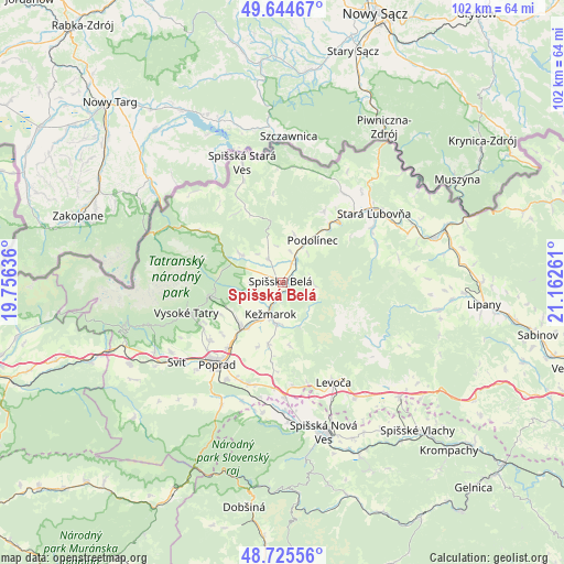
Spišská Belá GPS coordinates[2]
49° 11' 14.1" North, 20° 27' 34.128" East
| Map corner | latitude | longitude |
|---|---|---|
| Upper-left | 49.64467°, | 19.75636° |
| Center: | 49.18725°, | 20.45948° |
| Lower-right: | 48.72556°, | 21.16261° |
| Map W x H: | 102.2×102.2 km | = 63.5×63.5mi |
| max Lat: | 49.43503° ⇑14.7% North |
| Spišská Belá: | 49.18725° |
| min Lat: | ⇓85.3% South 47.76356° |
| min Long | Spišská Belá | max Long |
| 16.9786° | 20.45948° | 22.18136° |
| W 79.4%⇐ | ⇒20.6% E |
Elevation
Elevation of Spišská Belá is 625 m = 2051 ft, and this is 288.9 m = 948 ft above average elevation for this country.
| Max E: |
1006 m = 3301 ft | 10% |
| Spišská Belá | 625 m 2051 ft | |
| Avg. | 336.1 m = 1103 ft | |
Min E: |
102 m = 335 ft | 90% |
See also: Slovakia elevation on elevation.city.
Geographical zone
Spišská Belá is located in North temperate zone (between Tropic of Cancer and the Arctic Circle). Distance of this North polar circle is 1932.1 km =1200.6 mi to North.| Distance of | km | miles | from Spišská Belá |
|---|---|---|---|
| North Pole | 4538 | 2819.8 | to North |
| Arctic Circle | 1932.1 | 1200.6 | to North |
| Tropic Cancer | 2863.2 | 1779.1 | to South |
| Equator | 5469.1 | 3398.3 | to South |


Nearby cities:
15 places around Spišská Belá: (largest is in red/bold)
• Kežmarok
6 km =3.7 mi,  198°
198°
• Levoča
20.8 km =12.9 mi,  152°
152°
• Nová Lesná
15.7 km =9.8 mi,  242°
242°
• Podolínec
9.7 km =6 mi,  34°
34°
• Poprad
18.3 km =11.4 mi,  220°
220°
• Spišská Nová Ves
28 km =17.4 mi,  164°
164°
• Stará Ľubovňa
20.6 km =12.8 mi,  53°
53°
• Starý Smokovec
18.2 km =11.3 mi,  252°
252°
• Svit
23.2 km =14.4 mi,  232°
232°
• Tatranská Lomnica
13.2 km =8.2 mi,  259°
259°
• Vrbov
11.4 km =7.1 mi,  192°
192°
• Vysoké Tatry
16.7 km =10.4 mi, 250°
• Vyšné Ružbachy
15.1 km =9.4 mi, 30°
• Ľubica
7.9 km =4.9 mi, 185°
• Ždiar
17.1 km =10.6 mi,  303°
303°
Sources, notices
• [Note1] Compared only with cities in Slovakia existing in our database
• [Src1] Map data: © OpenStreetMap contributors (CC-BY-SA)
• [Src2] Other city data from geonames.org with taken over terms of usage.
• [Src3] Geographical zone / Annual Mean Temperature by Robert A. Rohde @ Wikipedia
