Kailahun geodata
Kailahun (Eastern Province) is a populated place; located in Sierra Leone in Africa/Freetown (GMT+0) time zone. With population of 14,085 people, there are 11 cities with bigger population in this country. Compared to other cities in Sierra Leone, 55.4% of cities are located further ↑North; 98.8% of cities are located further ←West and 80.7% of cities have lower elevation than Kailahun. Note1


Kailahun GPS coordinates[2]
8° 16' 44.04" North, 10° 34' 22.8" West
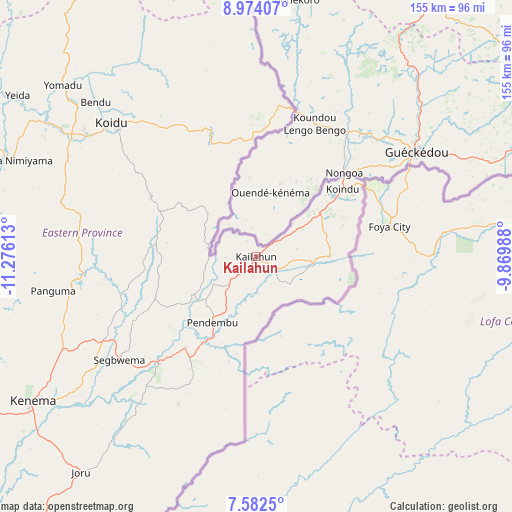
| Map corner | latitude | longitude |
|---|---|---|
| Upper-left | 8.97407°, | -11.27613° |
| Center: | 8.2789°, | -10.573° |
| Lower-right: | 7.5825°, | -9.86988° |
| Map W x H: | 154.7×154.7 km | = 96.1×96.1mi |
| max Lat: | 9.91376° ⇑55.4% North |
| Kailahun: | 8.2789° |
| min Lat: | ⇓44.6% South 7.24611° |
| min Long | Kailahun | max Long |
| -13.28972° | -10.573° | -10.37135° |
| W 98.8%⇐ | ⇒1.2% E |
Elevation
Elevation of Kailahun is 309 m = 1014 ft, and this is 151.8 m = 498 ft above average elevation for this country.
| Max E: |
564 m = 1850 ft | 19.3% |
| Kailahun | 309 m 1014 ft | |
| Avg. | 157.2 m = 516 ft | |
Min E: |
1 m = 3 ft | 80.7% |
See also: Sierra Leone elevation on elevation.city.
Geographical zone
Kailahun is located in North Torrid zone (between Equator and Tropic of Cancer). Distance of Equator is 920.5 km =572 mi to South.| Distance of | km | miles | from Kailahun |
|---|---|---|---|
| North Pole | 9086.5 | 5646.1 | to North |
| Arctic Circle | 6480.6 | 4026.9 | to North |
| Tropic Cancer | 1685.4 | 1047.3 | to North |
| Equator | 920.5 | 572 | to South |


Nearby cities:
15 places around Kailahun: (largest is in red/bold)
• Buedu
22.2 km =13.8 mi,  89°
89°
• Bunumbu
34.1 km =21.2 mi,  250°
250°
• Daru
43.7 km =27.2 mi,  222°
222°
• Giehun
60.1 km =37.3 mi,  300°
300°
• Jojoima
50.5 km =31.4 mi,  208°
208°
• Koidu
59.7 km =37.1 mi,  312°
312°
• Manowa
22.6 km =14 mi,  238°
238°
• Mobai
37.4 km =23.2 mi, 212°
• Motema
61.1 km =38 mi, 307°
• Panguma
62.5 km =38.8 mi,  260°
260°
• Pendembu
24.1 km =15 mi, 213°
• Segbwema
52.2 km =32.4 mi,  232°
232°
• Simbakoro
60.5 km =37.6 mi, 307°
• Tombodu
16.8 km =10.4 mi,  197°
197°
• Tombu
33.8 km =21 mi,  329°
329°
Sources, notices
• [Note1] Compared only with cities in Sierra Leone existing in our database
• [Src1] Map data: © OpenStreetMap contributors (CC-BY-SA)
• [Src2] Other city data from geonames.org with taken over terms of usage.
• [Src3] Geographical zone / Annual Mean Temperature by Robert A. Rohde @ Wikipedia
