Tadmur geodata
Tadmur (Homs) is a seat of a second-order administrative division; located in Syria in Asia/Damascus (GMT+3) time zone. With population of 51,015 people, there are 25 cities with bigger population in this country. Compared to other cities in Syria, 70.7% of cities are located further ↑North; 85.2% of cities are located further ←West and 58.7% of cities have higher elevation than Tadmur. Note1


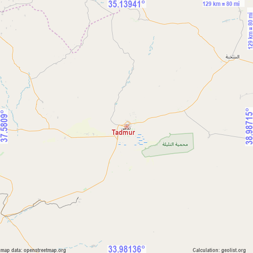
Tadmur GPS coordinates[2]
34° 33' 44.64" North, 38° 17' 2.472" East
| Map corner | latitude | longitude |
|---|---|---|
| Upper-left | 35.13941°, | 37.5809° |
| Center: | 34.5624°, | 38.28402° |
| Lower-right: | 33.98136°, | 38.98715° |
| Map W x H: | 128.8×128.8 km | = 80×80mi |
| max Lat: | 37.17701° ⇑70.7% North |
| Tadmur: | 34.5624° |
| min Lat: | ⇓29.3% South 32.39332° |
| min Long | Tadmur | max Long |
| 35.75572° | 38.28402° | 42.14006° |
| W 85.2%⇐ | ⇒14.8% E |
Elevation
Elevation of Tadmur is 418 m = 1371 ft, and this is 111.1 m = 365 ft below average elevation for this country.
| Max E: |
1640 m = 5381 ft | 58.7% |
| Avg. | 529.1 m = 1736 ft | |
| Tadmur | 418 m = 1371 ft | |
Min E: |
4 m = 13 ft | 41.3% |
See also: Tadmur elevation on elevation.city.
Geographical zone
Tadmur is located in North temperate zone (between Tropic of Cancer and the Arctic Circle). Distance of this Northern Tropic circle is 1237.1 km =768.7 mi to South.| Distance of | km | miles | from Tadmur |
|---|---|---|---|
| North Pole | 6164.1 | 3830.2 | to North |
| Arctic Circle | 3558.2 | 2211 | to North |
| Tropic Cancer | 1237.1 | 768.7 | to South |
| Equator | 3843 | 2387.9 | to South |


Nearby cities:
15 places around Tadmur: (largest is in red/bold)
• Al Furqlus
109.6 km =68.1 mi,  272°
272°
• Al Qaryatayn
102.6 km =63.8 mi,  248°
248°
• Ar Riqāmā
125 km =77.7 mi, 268°
• As Sab‘ Biyār
103.1 km =64.1 mi,  212°
212°
• As Salamīyah
123 km =76.4 mi,  293°
293°
• As Si‘in
113.9 km =70.8 mi,  313°
313°
• As Sukhnah
64.6 km =40.1 mi,  56°
56°
• Barrī ash Sharqī
109.3 km =67.9 mi,  295°
295°
• Jubb al Jarrāḩ
92.8 km =57.7 mi, 289°
• Mahīn
118 km =73.3 mi, 252°
• Mukharram al Fawqānī
113 km =70.2 mi,  284°
284°
• Nāḩiyat as Sab‘ Biyār
117.3 km =72.9 mi,  192°
192°
• Şabbūrah
118.2 km =73.4 mi, 303°
• Şadad
127.6 km =79.3 mi,  257°
257°
• ‘Uqayribāt
92 km =57.2 mi, 305°
In other languages:
- In Spanish: Palmira
- In France: Palmyre
- In German: Palmyra
- In Italian: Palmira
- In Russian: Пальмира
Sources, notices
• [Note1] Compared only with cities in Syria existing in our database
• [Src1] Map data: © OpenStreetMap contributors (CC-BY-SA)
• [Src2] Other city data from geonames.org with taken over terms of usage.
• [Src3] Geographical zone / Annual Mean Temperature by Robert A. Rohde @ Wikipedia
