Al Qaryatayn geodata
Al Qaryatayn (Homs) is a seat of a third-order administrative division; located in Syria in Asia/Damascus (GMT+3) time zone. With population of 31,748 people, there are 44 cities with bigger population in this country. Compared to other cities in Syria, 73.5% of cities are located further ↑North; 75.3% of cities are located further ←West and 81.3% of cities have lower elevation than Al Qaryatayn. Note1


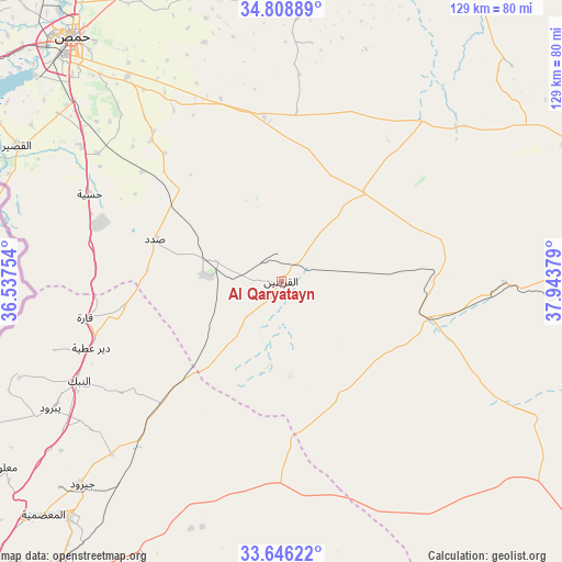
Al Qaryatayn GPS coordinates[2]
34° 13' 46.416" North, 37° 14' 26.376" East
| Map corner | latitude | longitude |
|---|---|---|
| Upper-left | 34.80889°, | 36.53754° |
| Center: | 34.22956°, | 37.24066° |
| Lower-right: | 33.64622°, | 37.94379° |
| Map W x H: | 129.3×129.3 km | = 80.3×80.3mi |
| max Lat: | 37.17701° ⇑73.5% North |
| Al Qaryatayn: | 34.22956° |
| min Lat: | ⇓26.5% South 32.39332° |
| min Long | Al Qaryatayn | max Long |
| 35.75572° | 37.24066° | 42.14006° |
| W 75.3%⇐ | ⇒24.7% E |
Elevation
Elevation of Al Qaryatayn is 745 m = 2444 ft, and this is 215.9 m = 708 ft above average elevation for this country.
| Max E: |
1640 m = 5381 ft | 18.7% |
| Al Qaryatayn | 745 m 2444 ft | |
| Avg. | 529.1 m = 1736 ft | |
Min E: |
4 m = 13 ft | 81.3% |
See also: Syria elevation on elevation.city.
Geographical zone
Al Qaryatayn is located in North temperate zone (between Tropic of Cancer and the Arctic Circle). Distance of this Northern Tropic circle is 1200.1 km =745.7 mi to South.| Distance of | km | miles | from Al Qaryatayn |
|---|---|---|---|
| North Pole | 6201.1 | 3853.2 | to North |
| Arctic Circle | 3595.2 | 2234 | to North |
| Tropic Cancer | 1200.1 | 745.7 | to South |
| Equator | 3806 | 2364.9 | to South |


Nearby cities:
15 places around Al Qaryatayn: (largest is in red/bold)
• Al Furqlus
44.2 km =27.5 mi,  341°
341°
• Al Quşayr
68 km =42.3 mi,  297°
297°
• An Nabk
52.4 km =32.6 mi,  244°
244°
• Ar Riqāmā
45.3 km =28.1 mi,  319°
319°
• As Sab‘ Biyār
64.6 km =40.1 mi,  140°
140°
• Dayr ‘Aţīyah
46 km =28.6 mi,  251°
251°
• Hisya
48.7 km =30.3 mi,  294°
294°
• Homs
72.8 km =45.2 mi, 319°
• Jayrūd
65.9 km =40.9 mi,  224°
224°
• Jubb al Jarrāḩ
67.7 km =42.1 mi,  6°
6°
• Mahīn
16.8 km =10.4 mi,  274°
274°
• Mukharram al Fawqānī
66.6 km =41.4 mi,  347°
347°
• Qārah
46.5 km =28.9 mi,  259°
259°
• Yabrūd
61 km =37.9 mi, 241°
• Şadad
30.4 km =18.9 mi, 287°
Sources, notices
• [Note1] Compared only with cities in Syria existing in our database
• [Src1] Map data: © OpenStreetMap contributors (CC-BY-SA)
• [Src2] Other city data from geonames.org with taken over terms of usage.
• [Src3] Geographical zone / Annual Mean Temperature by Robert A. Rohde @ Wikipedia
