Mahīn geodata
Mahīn (Homs) is a seat of a third-order administrative division; located in Syria in Asia/Damascus (GMT+3) time zone. In our database, there are 87 cities with bigger population. Compared to other cities in Syria, 73.1% of cities are located further ↑North; 71.4% of cities are located further ←West and 89.8% of cities have lower elevation than Mahīn. Note1


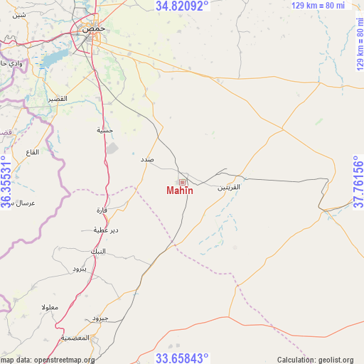
Mahīn GPS coordinates[2]
34° 14' 30.048" North, 37° 3' 30.348" East
| Map corner | latitude | longitude |
|---|---|---|
| Upper-left | 34.82092°, | 36.35531° |
| Center: | 34.24168°, | 37.05843° |
| Lower-right: | 33.65843°, | 37.76156° |
| Map W x H: | 129.3×129.3 km | = 80.3×80.3mi |
| max Lat: | 37.17701° ⇑73.1% North |
| Mahīn: | 34.24168° |
| min Lat: | ⇓26.9% South 32.39332° |
| min Long | Mahīn | max Long |
| 35.75572° | 37.05843° | 42.14006° |
| W 71.4%⇐ | ⇒28.6% E |
Elevation
Elevation of Mahīn is 924 m = 3031 ft, and this is 394.9 m = 1296 ft above average elevation for this country.
| Max E: |
1640 m = 5381 ft | 10.2% |
| Mahīn | 924 m 3031 ft | |
| Avg. | 529.1 m = 1736 ft | |
Min E: |
4 m = 13 ft | 89.8% |
See also: Syria elevation on elevation.city.
Geographical zone
Mahīn is located in North temperate zone (between Tropic of Cancer and the Arctic Circle). Distance of this Northern Tropic circle is 1201.4 km =746.5 mi to South.| Distance of | km | miles | from Mahīn |
|---|---|---|---|
| North Pole | 6199.7 | 3852.3 | to North |
| Arctic Circle | 3593.9 | 2233.1 | to North |
| Tropic Cancer | 1201.4 | 746.5 | to South |
| Equator | 3807.3 | 2365.7 | to South |


Nearby cities:
15 places around Mahīn: (largest is in red/bold)
• Al Furqlus
40.6 km =25.2 mi,  3°
3°
• Al Qaryatayn
16.8 km =10.4 mi,  94°
94°
• Al Quşayr
52.9 km =32.9 mi,  303°
303°
• An Nabk
38.8 km =24.1 mi,  231°
231°
• Ar Riqāmā
35.4 km =22 mi,  338°
338°
• Ar Ruḩaybah
64.2 km =39.9 mi,  210°
210°
• Dayr ‘Aţīyah
31.3 km =19.4 mi,  238°
238°
• Hisya
33.4 km =20.8 mi, 304°
• Homs
62.1 km =38.6 mi,  330°
330°
• Jayrūd
56.6 km =35.2 mi, 211°
• Ma‘lūlā
64.6 km =40.1 mi, 227°
• Mukharram al Fawqānī
63.8 km =39.6 mi, 2°
• Qārah
30.6 km =19 mi,  251°
251°
• Yabrūd
47.8 km =29.7 mi, 230°
• Şadad
14.5 km =9 mi, 302°
Sources, notices
• [Note1] Compared only with cities in Syria existing in our database
• [Src1] Map data: © OpenStreetMap contributors (CC-BY-SA)
• [Src2] Other city data from geonames.org with taken over terms of usage.
• [Src3] Geographical zone / Annual Mean Temperature by Robert A. Rohde @ Wikipedia
