Song Dao geodata
Song Dao (Sakon Nakhon) is a seat of a second-order administrative division; located in Thailand in Asia/Bangkok (GMT+7) time zone. In our database, there are 331 cities with bigger population. Compared to other cities in Thailand, 82.6% of cities are located further ↓South; 84.4% of cities are located further ←West and 81.6% of cities have lower elevation than Song Dao. Note1


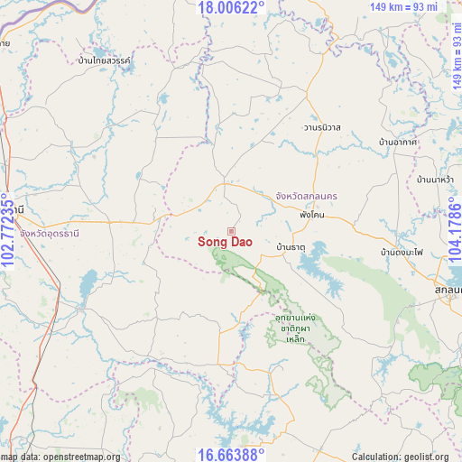
Song Dao GPS coordinates[2]
17° 20' 10.608" North, 103° 28' 31.692" East
| Map corner | latitude | longitude |
|---|---|---|
| Upper-left | 18.00622°, | 102.77235° |
| Center: | 17.33628°, | 103.47547° |
| Lower-right: | 16.66388°, | 104.1786° |
| Map W x H: | 149.3×149.3 km | = 92.8×92.8mi |
| max Lat: | 20.43353° ⇑17.4% North |
| Song Dao: | 17.33628° |
| min Lat: | ⇓82.6% South 5.77434° |
| min Long | Song Dao | max Long |
| 97.93288° | 103.47547° | 105.49506° |
| W 84.4%⇐ | ⇒15.6% E |
Elevation
Elevation of Song Dao is 202 m = 663 ft, and this is 76.5 m = 251 ft above average elevation for this country.
| Max E: |
1011 m = 3317 ft | 18.4% |
| Song Dao | 202 m 663 ft | |
| Avg. | 125.5 m = 412 ft | |
Min E: |
1 m = 3 ft | 81.6% |
See also: Thailand elevation on elevation.city.
Geographical zone
Song Dao is located in North Torrid zone (between Equator and Tropic of Cancer). Distance of this Northern Tropic circle is 678.3 km =421.5 mi to North.| Distance of | km | miles | from Song Dao |
|---|---|---|---|
| North Pole | 8079.4 | 5020.3 | to North |
| Arctic Circle | 5473.6 | 3401.1 | to North |
| Tropic Cancer | 678.3 | 421.5 | to North |
| Equator | 1927.6 | 1197.8 | to South |


Nearby cities:
15 places around Song Dao: (largest is in red/bold)
• Ban Dung
46.4 km =28.8 mi,  330°
330°
• Ban Nong Wua So
27.7 km =17.2 mi,  253°
253°
• Chaiwan
26.1 km =16.2 mi,  259°
259°
• Charoen Sin
27.9 km =17.3 mi,  14°
14°
• Ku Kaeo
38.8 km =24.1 mi,  241°
241°
• Kut Bak
45.7 km =28.4 mi,  127°
127°
• Nikhom Nam Un
30.9 km =19.2 mi,  123°
123°
• Nong Han
39.4 km =24.5 mi,  273°
273°
• Phang Khon
26.3 km =16.3 mi,  76°
76°
• Phanna Nikhom
39.8 km =24.7 mi,  87°
87°
• Sawang Daen Din
15.6 km =9.7 mi,  352°
352°
• Thung Fon
27.3 km =17 mi,  303°
303°
• Wang Sam Mo
42.8 km =26.6 mi,  185°
185°
• Wanon Niwat
44.2 km =27.5 mi,  41°
41°
• Warichaphum
17.9 km =11.1 mi,  105°
105°
Sources, notices
• [Note1] Compared only with cities in Thailand existing in our database
• [Src1] Map data: © OpenStreetMap contributors (CC-BY-SA)
• [Src2] Other city data from geonames.org with taken over terms of usage.
• [Src3] Geographical zone / Annual Mean Temperature by Robert A. Rohde @ Wikipedia
