Phang Khon geodata
Phang Khon (Sakon Nakhon) is a seat of a second-order administrative division; located in Thailand in Asia/Bangkok (GMT+7) time zone. In our database, there are 331 cities with bigger population. Compared to other cities in Thailand, 83% of cities are located further ↓South; 86.9% of cities are located further ←West and 70.1% of cities have lower elevation than Phang Khon. Note1


Phang Khon GPS coordinates[2]
17° 23' 25.836" North, 103° 43' 0.912" East
| Map corner | latitude | longitude |
|---|---|---|
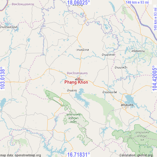
| Upper-left | 18.06025°, | 103.0138° |
| Center: | 17.39051°, | 103.71692° |
| Lower-right: | 16.71831°, | 104.42005° |
| Map W x H: | 149.2×149.2 km | = 92.7×92.7mi |
| max Lat: | 20.43353° ⇑17% North |
| Phang Khon: | 17.39051° |
| min Lat: | ⇓83% South 5.77434° |
| min Long | Phang Khon | max Long |
| 97.93288° | 103.71692° | 105.49506° |
| W 86.9%⇐ | ⇒13.1% E |
Elevation
Elevation of Phang Khon is 169 m = 554 ft, and this is 43.5 m = 143 ft above average elevation for this country.
| Max E: |
1011 m = 3317 ft | 29.9% |
| Phang Khon | 169 m 554 ft | |
| Avg. | 125.5 m = 412 ft | |
Min E: |
1 m = 3 ft | 70.1% |
See also: Thailand elevation on elevation.city.
Geographical zone
Phang Khon is located in North Torrid zone (between Equator and Tropic of Cancer). Distance of this Northern Tropic circle is 672.3 km =417.7 mi to North.| Distance of | km | miles | from Phang Khon |
|---|---|---|---|
| North Pole | 8073.4 | 5016.6 | to North |
| Arctic Circle | 5467.5 | 3397.3 | to North |
| Tropic Cancer | 672.3 | 417.7 | to North |
| Equator | 1933.6 | 1201.5 | to South |


Nearby cities:
15 places around Phang Khon: (largest is in red/bold)
• Akat Amnuai
36.2 km =22.5 mi,  50°
50°
• Charoen Sin
28.1 km =17.5 mi,  318°
318°
• Kham Muang
52 km =32.3 mi,  189°
189°
• Kham Ta Kla
51.5 km =32 mi,  4°
4°
• Kut Bak
35.2 km =21.9 mi,  162°
162°
• Na Wa
42.2 km =26.2 mi,  74°
74°
• Nikhom Nam Un
23.1 km =14.4 mi,  179°
179°
• Phanna Nikhom
14.8 km =9.2 mi,  106°
106°
• Phu Phan
51.4 km =31.9 mi,  147°
147°
• Sakon Nakhon
52.3 km =32.5 mi,  119°
119°
• Sawang Daen Din
29.1 km =18.1 mi,  288°
288°
• Song Dao
26.3 km =16.3 mi,  256°
256°
• Thung Fon
49.3 km =30.6 mi,  280°
280°
• Wanon Niwat
27.3 km =17 mi,  7°
7°
• Warichaphum
13.6 km =8.5 mi,  217°
217°
Sources, notices
• [Note1] Compared only with cities in Thailand existing in our database
• [Src1] Map data: © OpenStreetMap contributors (CC-BY-SA)
• [Src2] Other city data from geonames.org with taken over terms of usage.
• [Src3] Geographical zone / Annual Mean Temperature by Robert A. Rohde @ Wikipedia
