Sawang Daen Din geodata
Sawang Daen Din (Sakon Nakhon) is a seat of a second-order administrative division; located in Thailand in Asia/Bangkok (GMT+7) time zone. With population of 16,825 people, there are 193 cities with bigger population in this country. Compared to other cities in Thailand, 83.8% of cities are located further ↓South; 84.2% of cities are located further ←West and 70.1% of cities have lower elevation than Sawang Daen Din. Note1


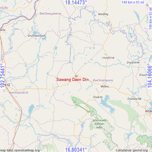
Sawang Daen Din GPS coordinates[2]
17° 28' 31.116" North, 103° 27' 27.108" East
| Map corner | latitude | longitude |
|---|---|---|
| Upper-left | 18.14473°, | 102.75441° |
| Center: | 17.47531°, | 103.45753° |
| Lower-right: | 16.80341°, | 104.16066° |
| Map W x H: | 149.1×149.1 km | = 92.6×92.6mi |
| max Lat: | 20.43353° ⇑16.2% North |
| Sawang Daen Din: | 17.47531° |
| min Lat: | ⇓83.8% South 5.77434° |
| min Long | Sawang Daen Din | max Long |
| 97.93288° | 103.45753° | 105.49506° |
| W 84.2%⇐ | ⇒15.8% E |
Elevation
Elevation of Sawang Daen Din is 169 m = 554 ft, and this is 43.5 m = 143 ft above average elevation for this country.
| Max E: |
1011 m = 3317 ft | 29.9% |
| Sawang Daen Din | 169 m 554 ft | |
| Avg. | 125.5 m = 412 ft | |
Min E: |
1 m = 3 ft | 70.1% |
See also: Thailand elevation on elevation.city.
Geographical zone
Sawang Daen Din is located in North Torrid zone (between Equator and Tropic of Cancer). Distance of this Northern Tropic circle is 662.8 km =411.8 mi to North.| Distance of | km | miles | from Sawang Daen Din |
|---|---|---|---|
| North Pole | 8064 | 5010.7 | to North |
| Arctic Circle | 5458.1 | 3391.5 | to North |
| Tropic Cancer | 662.8 | 411.8 | to North |
| Equator | 1943.1 | 1207.4 | to South |


Nearby cities:
15 places around Sawang Daen Din: (largest is in red/bold)
• Ban Dung
32.5 km =20.2 mi,  319°
319°
• Ban Muang
43.4 km =27 mi,  15°
15°
• Ban Nong Wua So
33.8 km =21 mi,  226°
226°
• Chaiwan
31.1 km =19.3 mi, 229°
• Charoen Sin
14.5 km =9 mi,  37°
37°
• Ku Kaeo
46.7 km =29 mi,  223°
223°
• Nikhom Nam Un
42.7 km =26.5 mi,  139°
139°
• Nong Han
39.5 km =24.5 mi,  251°
251°
• Phang Khon
29.1 km =18.1 mi,  108°
108°
• Phanna Nikhom
43.9 km =27.3 mi, 108°
• Phibun Rak
43.2 km =26.8 mi,  281°
281°
• Song Dao
15.6 km =9.7 mi,  172°
172°
• Thung Fon
20.9 km =13 mi,  268°
268°
• Wanon Niwat
35.9 km =22.3 mi,  60°
60°
• Warichaphum
27.8 km =17.3 mi, 136°
Sources, notices
• [Note1] Compared only with cities in Thailand existing in our database
• [Src1] Map data: © OpenStreetMap contributors (CC-BY-SA)
• [Src2] Other city data from geonames.org with taken over terms of usage.
• [Src3] Geographical zone / Annual Mean Temperature by Robert A. Rohde @ Wikipedia
