Ko Chang Tai geodata
Ko Chang Tai (Trat) is a seat of a third-order administrative division; located in Thailand in Asia/Bangkok (GMT+7) time zone. With population of 2,346 people, there are 319 cities with bigger population in this country. Compared to other cities in Thailand, 81.3% of cities are located further ↑North; 71.5% of cities are located further ←West and 98% of cities have higher elevation than Ko Chang Tai. Note1


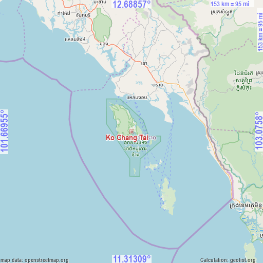
Ko Chang Tai GPS coordinates[2]
12° 0' 6.156" North, 102° 22' 21.612" East
| Map corner | latitude | longitude |
|---|---|---|
| Upper-left | 12.68857°, | 101.66955° |
| Center: | 12.00171°, | 102.37267° |
| Lower-right: | 11.31309°, | 103.0758° |
| Map W x H: | 152.9×152.9 km | = 95×95mi |
| max Lat: | 20.43353° ⇑81.3% North |
| Ko Chang Tai: | 12.00171° |
| min Lat: | ⇓18.7% South 5.77434° |
| min Long | Ko Chang Tai | max Long |
| 97.93288° | 102.37267° | 105.49506° |
| W 71.5%⇐ | ⇒28.5% E |
Elevation
Elevation of Ko Chang Tai is 5 m = 16 ft, and this is 120.5 m = 395 ft below average elevation for this country.
| Max E: |
1011 m = 3317 ft | 98% |
| Avg. | 125.5 m = 412 ft | |
| Ko Chang Tai | 5 m = 16 ft | |
Min E: |
1 m = 3 ft | 2% |
See also: Thailand elevation on elevation.city.
Geographical zone
Ko Chang Tai is located in North Torrid zone (between Equator and Tropic of Cancer). Distance of this Northern Tropic circle is 1271.5 km =790.1 mi to North.| Distance of | km | miles | from Ko Chang Tai |
|---|---|---|---|
| North Pole | 8672.6 | 5388.9 | to North |
| Arctic Circle | 6066.7 | 3769.7 | to North |
| Tropic Cancer | 1271.5 | 790.1 | to North |
| Equator | 1334.5 | 829.2 | to South |


Nearby cities:
15 places around Ko Chang Tai: (largest is in red/bold)
• Ban Bang Bao
7.4 km =4.6 mi,  244°
244°
• Bo Rai
66 km =41 mi,  15°
15°
• Chanthaburi
73.6 km =45.7 mi,  336°
336°
• Khao Khitchakut
93.6 km =58.2 mi, 342°
• Khao Saming
39.7 km =24.7 mi,  9°
9°
• Khlong Yai
61.2 km =38 mi,  114°
114°
• Khlung
53 km =32.9 mi, 341°
• Ko Kut
42.4 km =26.3 mi,  154°
154°
• Laem Ngop
19.1 km =11.9 mi, 7°
• Laem Sing
62.5 km =38.8 mi,  328°
328°
• Makham
77.1 km =47.9 mi,  345°
345°
• Na Yai Am
105.3 km =65.4 mi, 325°
• Pong Nam Ron
101.2 km =62.9 mi, 353°
• Tha Mai
79.6 km =49.5 mi, 329°
• Trat
31 km =19.3 mi,  29°
29°
Sources, notices
• [Note1] Compared only with cities in Thailand existing in our database
• [Src1] Map data: © OpenStreetMap contributors (CC-BY-SA)
• [Src2] Other city data from geonames.org with taken over terms of usage.
• [Src3] Geographical zone / Annual Mean Temperature by Robert A. Rohde @ Wikipedia
