Phanat Nikhom geodata
Phanat Nikhom (Chon Buri) is a seat of a second-order administrative division; located in Thailand in Asia/Bangkok (GMT+7) time zone. With population of 21,924 people, there are 143 cities with bigger population in this country. Compared to other cities in Thailand, 75.6% of cities are located further ↑North; 57.3% of cities are located further ←West and 80.8% of cities have higher elevation than Phanat Nikhom. Note1


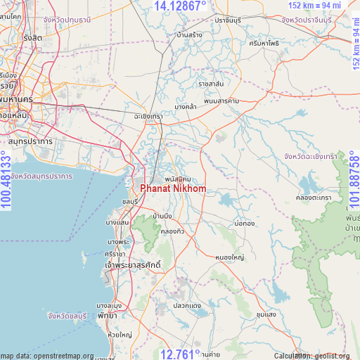
Phanat Nikhom GPS coordinates[2]
13° 26' 44.916" North, 101° 11' 4.02" East
| Map corner | latitude | longitude |
|---|---|---|
| Upper-left | 14.12867°, | 100.48133° |
| Center: | 13.44581°, | 101.18445° |
| Lower-right: | 12.761°, | 101.88758° |
| Map W x H: | 152.1×152.1 km | = 94.5×94.5mi |
| max Lat: | 20.43353° ⇑75.6% North |
| Phanat Nikhom: | 13.44581° |
| min Lat: | ⇓24.4% South 5.77434° |
| min Long | Phanat Nikhom | max Long |
| 97.93288° | 101.18445° | 105.49506° |
| W 57.3%⇐ | ⇒42.7% E |
Elevation
Elevation of Phanat Nikhom is 12 m = 39 ft, and this is 113.5 m = 372 ft below average elevation for this country.
| Max E: |
1011 m = 3317 ft | 80.8% |
| Avg. | 125.5 m = 412 ft | |
| Phanat Nikhom | 12 m = 39 ft | |
Min E: |
1 m = 3 ft | 19.2% |
See also: Thailand elevation on elevation.city.
Geographical zone
Phanat Nikhom is located in North Torrid zone (between Equator and Tropic of Cancer). Distance of this Northern Tropic circle is 1110.9 km =690.3 mi to North.| Distance of | km | miles | from Phanat Nikhom |
|---|---|---|---|
| North Pole | 8512 | 5289.1 | to North |
| Arctic Circle | 5906.1 | 3669.9 | to North |
| Tropic Cancer | 1110.9 | 690.3 | to North |
| Equator | 1495 | 928.9 | to South |


Nearby cities:
15 places around Phanat Nikhom: (largest is in red/bold)
• Ban Bueng
16.9 km =10.5 mi,  207°
207°
• Ban Pho
20.4 km =12.7 mi,  326°
326°
• Bang Khla
30.8 km =19.1 mi,  4°
4°
• Bang Pakong
23.3 km =14.5 mi,  297°
297°
• Bo Thong
33.4 km =20.8 mi,  123°
123°
• Chachoengsao
29.6 km =18.4 mi,  335°
335°
• Chon Buri
23.6 km =14.7 mi,  246°
246°
• Khlong Khuean
38.5 km =23.9 mi,  356°
356°
• Ko Chan
16.6 km =10.3 mi,  101°
101°
• Nong Yai
38.2 km =23.7 mi,  147°
147°
• Phan Thong
10 km =6.2 mi,  284°
284°
• Phanom Sarakham
38.1 km =23.7 mi,  27°
27°
• Plaeng Yao
18.8 km =11.7 mi, 34°
• Ratchasan
38.8 km =24.1 mi,  15°
15°
• Sanam Chai Khet
36.3 km =22.6 mi,  49°
49°
Sources, notices
• [Note1] Compared only with cities in Thailand existing in our database
• [Src1] Map data: © OpenStreetMap contributors (CC-BY-SA)
• [Src2] Other city data from geonames.org with taken over terms of usage.
• [Src3] Geographical zone / Annual Mean Temperature by Robert A. Rohde @ Wikipedia
