Chaloem Phra Kiat geodata
Chaloem Phra Kiat (Buriram) is a seat of a second-order administrative division; located in Thailand in Asia/Bangkok (GMT+7) time zone. In our database, there are 331 cities with bigger population. Compared to other cities in Thailand, 58.8% of cities are located further ↑North; 78.3% of cities are located further ←West and 82.1% of cities have lower elevation than Chaloem Phra Kiat. Note1


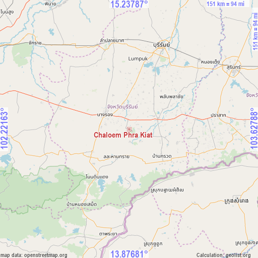
Chaloem Phra Kiat GPS coordinates[2]
14° 33' 30.204" North, 102° 55' 29.1" East
| Map corner | latitude | longitude |
|---|---|---|
| Upper-left | 15.23787°, | 102.22163° |
| Center: | 14.55839°, | 102.92475° |
| Lower-right: | 13.87681°, | 103.62788° |
| Map W x H: | 151.3×151.3 km | = 94×94mi |
| max Lat: | 20.43353° ⇑58.8% North |
| Chaloem Phra Kiat: | 14.55839° |
| min Lat: | ⇓41.2% South 5.77434° |
| min Long | Chaloem Phra Ki | max Long |
| 97.93288° | 102.92475° | 105.49506° |
| W 78.3%⇐ | ⇒21.7% E |
Elevation
Elevation of Chaloem Phra Kiat is 203 m = 666 ft, and this is 77.5 m = 254 ft above average elevation for this country.
| Max E: |
1011 m = 3317 ft | 17.9% |
| Chaloem Phra Kiat | 203 m 666 ft | |
| Avg. | 125.5 m = 412 ft | |
Min E: |
1 m = 3 ft | 82.1% |
See also: Thailand elevation on elevation.city.
Geographical zone
Chaloem Phra Kiat is located in North Torrid zone (between Equator and Tropic of Cancer). Distance of this Northern Tropic circle is 987.2 km =613.4 mi to North.| Distance of | km | miles | from Chaloem Phra Kiat |
|---|---|---|---|
| North Pole | 8388.3 | 5212.2 | to North |
| Arctic Circle | 5782.4 | 3593 | to North |
| Tropic Cancer | 987.2 | 613.4 | to North |
| Equator | 1618.7 | 1005.8 | to South |


Nearby cities:
15 places around Chaloem Phra Kiat: (largest is in red/bold)
• Ban Kruat
24.1 km =15 mi,  128°
128°
• Chamni
27.6 km =17.1 mi,  336°
336°
• Lahan Sai
17.8 km =11.1 mi,  203°
203°
• Nang Rong
16.8 km =10.4 mi,  301°
301°
• Non Din Daeng
33.2 km =20.6 mi,  214°
214°
• Non Suwan
35.4 km =22 mi,  273°
273°
• Nong Hong
41.3 km =25.7 mi,  321°
321°
• Nong Ki
44 km =27.3 mi,  288°
288°
• Pa Kham
25.3 km =15.7 mi,  238°
238°
• Pakham
25.3 km =15.7 mi, 238°
• Phanom Dong Rak
42.8 km =26.6 mi,  107°
107°
• Phlapphla Chai
32.3 km =20.1 mi,  53°
53°
• Prakhon Chai
17.6 km =10.9 mi,  70°
70°
• Prakhon Chai
21.7 km =13.5 mi,  75°
75°
• Soeng Sang
52.1 km =32.4 mi,  253°
253°
Sources, notices
• [Note1] Compared only with cities in Thailand existing in our database
• [Src1] Map data: © OpenStreetMap contributors (CC-BY-SA)
• [Src2] Other city data from geonames.org with taken over terms of usage.
• [Src3] Geographical zone / Annual Mean Temperature by Robert A. Rohde @ Wikipedia
