Phanom Dong Rak geodata
Phanom Dong Rak (Surin) is a seat of a second-order administrative division; located in Thailand in Asia/Bangkok (GMT+7) time zone. In our database, there are 331 cities with bigger population. Compared to other cities in Thailand, 60.4% of cities are located further ↑North; 83.2% of cities are located further ←West and 78.8% of cities have lower elevation than Phanom Dong Rak. Note1


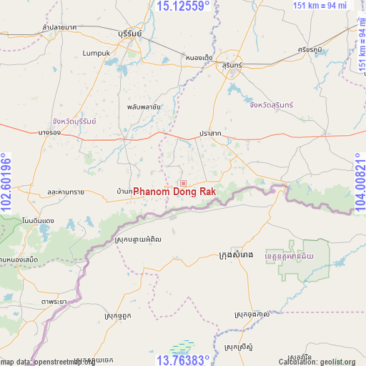
Phanom Dong Rak GPS coordinates[2]
14° 26' 44.7" North, 103° 18' 18.288" East
| Map corner | latitude | longitude |
|---|---|---|
| Upper-left | 15.12559°, | 102.60196° |
| Center: | 14.44575°, | 103.30508° |
| Lower-right: | 13.76383°, | 104.00821° |
| Map W x H: | 151.4×151.4 km | = 94.1×94.1mi |
| max Lat: | 20.43353° ⇑60.4% North |
| Phanom Dong Rak: | 14.44575° |
| min Lat: | ⇓39.6% South 5.77434° |
| min Long | Phanom Dong Rak | max Long |
| 97.93288° | 103.30508° | 105.49506° |
| W 83.2%⇐ | ⇒16.8% E |
Elevation
Elevation of Phanom Dong Rak is 193 m = 633 ft, and this is 67.5 m = 221 ft above average elevation for this country.
| Max E: |
1011 m = 3317 ft | 21.2% |
| Phanom Dong Rak | 193 m 633 ft | |
| Avg. | 125.5 m = 412 ft | |
Min E: |
1 m = 3 ft | 78.8% |
See also: Thailand elevation on elevation.city.
Geographical zone
Phanom Dong Rak is located in North Torrid zone (between Equator and Tropic of Cancer). Distance of this Northern Tropic circle is 999.7 km =621.2 mi to North.| Distance of | km | miles | from Phanom Dong Rak |
|---|---|---|---|
| North Pole | 8400.8 | 5220 | to North |
| Arctic Circle | 5795 | 3600.8 | to North |
| Tropic Cancer | 999.7 | 621.2 | to North |
| Equator | 1606.2 | 998 | to South |


Nearby cities:
15 places around Phanom Dong Rak: (largest is in red/bold)
• Ban Kruat
22.3 km =13.9 mi,  263°
263°
• Chaloem Phra Kiat
42.8 km =26.6 mi,  287°
287°
• Huai Rat
58.6 km =36.4 mi,  347°
347°
• Kap Choeng
31.3 km =19.4 mi,  84°
84°
• Krasang
53.1 km =33 mi,  359°
359°
• Lahan Sai
48.1 km =29.9 mi,  265°
265°
• Lamduan
49.8 km =30.9 mi,  51°
51°
• Nang Rong
59.3 km =36.8 mi, 291°
• Non Din Daeng
61.8 km =38.4 mi, 256°
• Pa Kham
62.4 km =38.8 mi, 269°
• Phlapphla Chai
34.9 km =21.7 mi,  334°
334°
• Prakhon Chai
26.7 km =16.6 mi,  311°
311°
• Prakhon Chai
30.5 km =19 mi, 307°
• Prasat
24.1 km =15 mi,  26°
26°
• Surin
52.6 km =32.7 mi,  22°
22°
Sources, notices
• [Note1] Compared only with cities in Thailand existing in our database
• [Src1] Map data: © OpenStreetMap contributors (CC-BY-SA)
• [Src2] Other city data from geonames.org with taken over terms of usage.
• [Src3] Geographical zone / Annual Mean Temperature by Robert A. Rohde @ Wikipedia
