Phlapphla Chai geodata
Phlapphla Chai (Buriram) is a seat of a second-order administrative division; located in Thailand in Asia/Bangkok (GMT+7) time zone. In our database, there are 331 cities with bigger population. Compared to other cities in Thailand, 55% of cities are located further ↑North; 81.1% of cities are located further ←West and 65.9% of cities have lower elevation than Phlapphla Chai. Note1


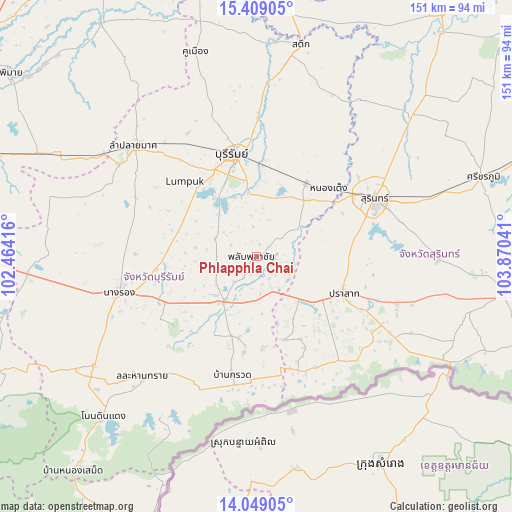
Phlapphla Chai GPS coordinates[2]
14° 43' 48.396" North, 103° 10' 2.208" East
| Map corner | latitude | longitude |
|---|---|---|
| Upper-left | 15.40905°, | 102.46416° |
| Center: | 14.73011°, | 103.16728° |
| Lower-right: | 14.04905°, | 103.87041° |
| Map W x H: | 151.2×151.2 km | = 94×94mi |
| max Lat: | 20.43353° ⇑55% North |
| Phlapphla Chai: | 14.73011° |
| min Lat: | ⇓45% South 5.77434° |
| min Long | Phlapphla Chai | max Long |
| 97.93288° | 103.16728° | 105.49506° |
| W 81.1%⇐ | ⇒18.9% E |
Elevation
Elevation of Phlapphla Chai is 161 m = 528 ft, and this is 35.5 m = 116 ft above average elevation for this country.
| Max E: |
1011 m = 3317 ft | 34.1% |
| Phlapphla Chai | 161 m 528 ft | |
| Avg. | 125.5 m = 412 ft | |
Min E: |
1 m = 3 ft | 65.9% |
See also: Thailand elevation on elevation.city.
Geographical zone
Phlapphla Chai is located in North Torrid zone (between Equator and Tropic of Cancer). Distance of this Northern Tropic circle is 968.1 km =601.5 mi to North.| Distance of | km | miles | from Phlapphla Chai |
|---|---|---|---|
| North Pole | 8369.2 | 5200.4 | to North |
| Arctic Circle | 5763.3 | 3581.1 | to North |
| Tropic Cancer | 968.1 | 601.5 | to North |
| Equator | 1637.8 | 1017.7 | to South |


Nearby cities:
15 places around Phlapphla Chai: (largest is in red/bold)
• Ban Dan
42.1 km =26.2 mi,  1°
1°
• Ban Kruat
34.9 km =21.7 mi,  192°
192°
• Buri Ram
30.2 km =18.8 mi,  346°
346°
• Chaloem Phra Kiat
32.3 km =20.1 mi,  233°
233°
• Chamni
37.6 km =23.4 mi,  279°
279°
• Huai Rat
25.7 km =16 mi,  5°
5°
• Krasang
26 km =16.2 mi,  34°
34°
• Lahan Sai
48.5 km =30.1 mi,  223°
223°
• Lam Plai Mat
48.2 km =30 mi,  312°
312°
• Nang Rong
41.7 km =25.9 mi,  255°
255°
• Phanom Dong Rak
34.9 km =21.7 mi,  154°
154°
• Prakhon Chai
14.7 km =9.1 mi,  199°
199°
• Prakhon Chai
16.3 km =10.1 mi, 215°
• Prasat
27.4 km =17 mi,  111°
111°
• Surin
38.9 km =24.2 mi,  64°
64°
Sources, notices
• [Note1] Compared only with cities in Thailand existing in our database
• [Src1] Map data: © OpenStreetMap contributors (CC-BY-SA)
• [Src2] Other city data from geonames.org with taken over terms of usage.
• [Src3] Geographical zone / Annual Mean Temperature by Robert A. Rohde @ Wikipedia
