Bua Lai geodata
Bua Lai (Nakhon Ratchasima) is a seat of a second-order administrative division; located in Thailand in Asia/Bangkok (GMT+7) time zone. In our database, there are 331 cities with bigger population. Compared to other cities in Thailand, 61% of cities are located further ↓South; 73% of cities are located further ←West and 79.7% of cities have lower elevation than Bua Lai. Note1


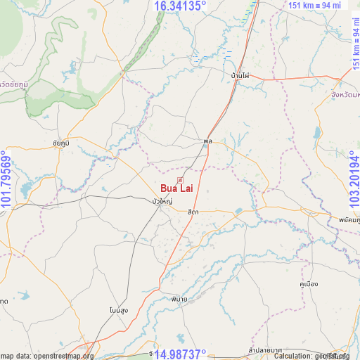
Bua Lai GPS coordinates[2]
15° 39' 55.728" North, 102° 29' 55.716" East
| Map corner | latitude | longitude |
|---|---|---|
| Upper-left | 16.34135°, | 101.79569° |
| Center: | 15.66548°, | 102.49881° |
| Lower-right: | 14.98737°, | 103.20194° |
| Map W x H: | 150.5×150.6 km | = 93.5×93.6mi |
| max Lat: | 20.43353° ⇑39% North |
| Bua Lai: | 15.66548° |
| min Lat: | ⇓61% South 5.77434° |
| min Long | Bua Lai | max Long |
| 97.93288° | 102.49881° | 105.49506° |
| W 73%⇐ | ⇒27% E |
Elevation
Elevation of Bua Lai is 196 m = 643 ft, and this is 70.5 m = 231 ft above average elevation for this country.
| Max E: |
1011 m = 3317 ft | 20.3% |
| Bua Lai | 196 m 643 ft | |
| Avg. | 125.5 m = 412 ft | |
Min E: |
1 m = 3 ft | 79.7% |
See also: Thailand elevation on elevation.city.
Geographical zone
Bua Lai is located in North Torrid zone (between Equator and Tropic of Cancer). Distance of this Northern Tropic circle is 864.1 km =536.9 mi to North.| Distance of | km | miles | from Bua Lai |
|---|---|---|---|
| North Pole | 8265.2 | 5135.8 | to North |
| Arctic Circle | 5659.3 | 3516.5 | to North |
| Tropic Cancer | 864.1 | 536.9 | to North |
| Equator | 1741.8 | 1082.3 | to South |


Nearby cities:
15 places around Bua Lai: (largest is in red/bold)
• Ban Lueam
40.1 km =24.9 mi,  261°
261°
• Ban Mai Chaiyaphot
37.2 km =23.1 mi,  105°
105°
• Bua Yai
11.8 km =7.3 mi,  221°
221°
• Chum Phuang
43.8 km =27.2 mi,  143°
143°
• Kaeng Sanam Nang
27.7 km =17.2 mi,  289°
289°
• Khok Pho Chai
47.7 km =29.6 mi,  347°
347°
• Khon Sawan
37.7 km =23.4 mi,  321°
321°
• Khong
30.6 km =19 mi, 216°
• Non Daeng
28.7 km =17.8 mi,  171°
171°
• Non Sila
38.9 km =24.2 mi,  28°
28°
• Phon
19.9 km =12.4 mi, 32°
• Prathai
28.1 km =17.5 mi,  121°
121°
• Sida
14.8 km =9.2 mi,  150°
150°
• Waeng Noi
17.7 km =11 mi,  330°
330°
• Waeng Yai
32.7 km =20.3 mi,  9°
9°
Sources, notices
• [Note1] Compared only with cities in Thailand existing in our database
• [Src1] Map data: © OpenStreetMap contributors (CC-BY-SA)
• [Src2] Other city data from geonames.org with taken over terms of usage.
• [Src3] Geographical zone / Annual Mean Temperature by Robert A. Rohde @ Wikipedia
