Ban Lueam geodata
Ban Lueam (Nakhon Ratchasima) is a seat of a second-order administrative division; located in Thailand in Asia/Bangkok (GMT+7) time zone. In our database, there are 331 cities with bigger population. Compared to other cities in Thailand, 59.8% of cities are located further ↓South; 68.4% of cities are located further ←West and 79.2% of cities have lower elevation than Ban Lueam. Note1


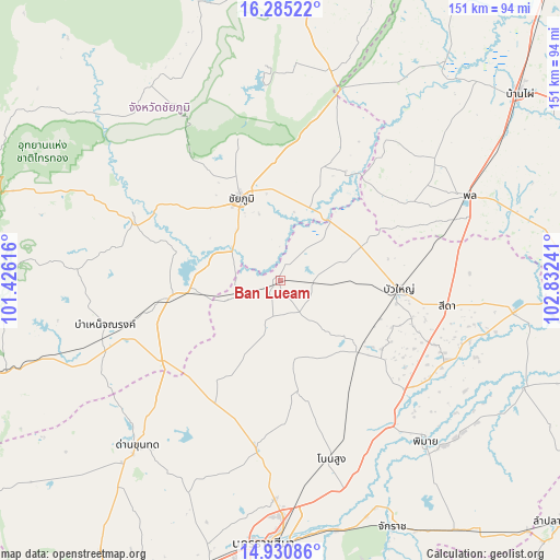
Ban Lueam GPS coordinates[2]
15° 36' 32.976" North, 102° 7' 45.408" East
| Map corner | latitude | longitude |
|---|---|---|
| Upper-left | 16.28522°, | 101.42616° |
| Center: | 15.60916°, | 102.12928° |
| Lower-right: | 14.93086°, | 102.83241° |
| Map W x H: | 150.6×150.6 km | = 93.6×93.6mi |
| max Lat: | 20.43353° ⇑40.2% North |
| Ban Lueam: | 15.60916° |
| min Lat: | ⇓59.8% South 5.77434° |
| min Long | Ban Lueam | max Long |
| 97.93288° | 102.12928° | 105.49506° |
| W 68.4%⇐ | ⇒31.6% E |
Elevation
Elevation of Ban Lueam is 194 m = 636 ft, and this is 68.5 m = 225 ft above average elevation for this country.
| Max E: |
1011 m = 3317 ft | 20.8% |
| Ban Lueam | 194 m 636 ft | |
| Avg. | 125.5 m = 412 ft | |
Min E: |
1 m = 3 ft | 79.2% |
See also: Thailand elevation on elevation.city.
Geographical zone
Ban Lueam is located in North Torrid zone (between Equator and Tropic of Cancer). Distance of this Northern Tropic circle is 870.3 km =540.8 mi to North.| Distance of | km | miles | from Ban Lueam |
|---|---|---|---|
| North Pole | 8271.5 | 5139.7 | to North |
| Arctic Circle | 5665.6 | 3520.4 | to North |
| Tropic Cancer | 870.3 | 540.8 | to North |
| Equator | 1735.6 | 1078.5 | to South |


Nearby cities:
15 places around Ban Lueam: (largest is in red/bold)
• Ban Khwao
30.3 km =18.8 mi,  308°
308°
• Bua Lai
40.1 km =24.9 mi,  81°
81°
• Bua Yai
31.9 km =19.8 mi,  94°
94°
• Chaiyaphum
24.8 km =15.4 mi,  334°
334°
• Chatturat
30.8 km =19.1 mi,  260°
260°
• Kaeng Sanam Nang
20.6 km =12.8 mi,  40°
40°
• Kham Sakae Saeng
31.1 km =19.3 mi,  171°
171°
• Khon Sawan
39.4 km =24.5 mi,  24°
24°
• Khong
28.2 km =17.5 mi,  130°
130°
• Noen Sa-nga
14.6 km =9.1 mi,  249°
249°
• Non Thai
46.4 km =28.8 mi,  187°
187°
• Nong Bua Rawe
42.3 km =26.3 mi,  292°
292°
• Phra Thong Kham
39.8 km =24.7 mi,  197°
197°
• Sida
47.3 km =29.4 mi,  97°
97°
• Waeng Noi
37.5 km =23.3 mi,  54°
54°
Sources, notices
• [Note1] Compared only with cities in Thailand existing in our database
• [Src1] Map data: © OpenStreetMap contributors (CC-BY-SA)
• [Src2] Other city data from geonames.org with taken over terms of usage.
• [Src3] Geographical zone / Annual Mean Temperature by Robert A. Rohde @ Wikipedia
