Kong Ra geodata
Kong Ra (Phatthalung) is a seat of a second-order administrative division; located in Thailand in Asia/Bangkok (GMT+7) time zone. In our database, there are 331 cities with bigger population. Compared to other cities in Thailand, 93.3% of cities are located further ↑North; 74.2% of cities are located further →East and 55.8% of cities have higher elevation than Kong Ra. Note1


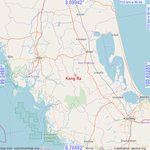
Kong Ra GPS coordinates[2]
7° 24' 9.792" North, 99° 56' 58.992" East
| Map corner | latitude | longitude |
|---|---|---|
| Upper-left | 8.09942°, | 99.2466° |
| Center: | 7.40272°, | 99.94972° |
| Lower-right: | 6.70492°, | 100.65285° |
| Map W x H: | 155.1×155.1 km | = 96.4×96.4mi |
| max Lat: | 20.43353° ⇑93.3% North |
| Kong Ra: | 7.40272° |
| min Lat: | ⇓6.7% South 5.77434° |
| min Long | Kong Ra | max Long |
| 97.93288° | 99.94972° | 105.49506° |
| W 25.8%⇐ | ⇒74.2% E |
Elevation
Elevation of Kong Ra is 56 m = 184 ft, and this is 69.5 m = 228 ft below average elevation for this country.
| Max E: |
1011 m = 3317 ft | 55.8% |
| Avg. | 125.5 m = 412 ft | |
| Kong Ra | 56 m = 184 ft | |
Min E: |
1 m = 3 ft | 44.2% |
See also: Thailand elevation on elevation.city.
Geographical zone
Kong Ra is located in North Torrid zone (between Equator and Tropic of Cancer). Distance of Equator is 823.1 km =511.5 mi to South.| Distance of | km | miles | from Kong Ra |
|---|---|---|---|
| North Pole | 9184 | 5706.7 | to North |
| Arctic Circle | 6578.1 | 4087.4 | to North |
| Tropic Cancer | 1782.8 | 1107.8 | to North |
| Equator | 823.1 | 511.5 | to South |


Nearby cities:
15 places around Kong Ra: (largest is in red/bold)
• Bang Kaeo
25.3 km =15.7 mi,  83°
83°
• Khao Chaison
21.3 km =13.2 mi,  72°
72°
• Khuan Khanun
37.5 km =23.3 mi,  10°
10°
• Manang
45 km =28 mi,  183°
183°
• Na Yong
33.2 km =20.6 mi,  302°
302°
• Pa Bon
28.5 km =17.7 mi,  121°
121°
• Pak Phayun
41.1 km =25.5 mi,  99°
99°
• Palian
38.7 km =24 mi,  228°
228°
• Phatthalung
27.8 km =17.3 mi,  30°
30°
• Si Banphot
36.2 km =22.5 mi,  348°
348°
• Srinagarindra
18.6 km =11.6 mi,  357°
357°
• Tamot
19.2 km =11.9 mi,  111°
111°
• Thung Wa
39 km =24.2 mi,  213°
213°
• Trang
41 km =25.5 mi,  294°
294°
• Yan Ta Khao
31.2 km =19.4 mi,  266°
266°
Sources, notices
• [Note1] Compared only with cities in Thailand existing in our database
• [Src1] Map data: © OpenStreetMap contributors (CC-BY-SA)
• [Src2] Other city data from geonames.org with taken over terms of usage.
• [Src3] Geographical zone / Annual Mean Temperature by Robert A. Rohde @ Wikipedia
