Phatthalung geodata
Phatthalung is a seat of a first-order administrative division; located in Thailand in Asia/Bangkok (GMT+7) time zone. With population of 43,522 people, there are 68 cities with bigger population in this country. Compared to other cities in Thailand, 92.1% of cities are located further ↑North; 70.4% of cities are located further →East and 76.7% of cities have higher elevation than Phatthalung. Note1


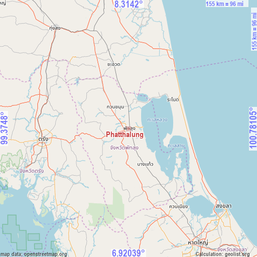
Phatthalung GPS coordinates[2]
7° 37' 4.296" North, 100° 4' 40.512" East
| Map corner | latitude | longitude |
|---|---|---|
| Upper-left | 8.3142°, | 99.3748° |
| Center: | 7.61786°, | 100.07792° |
| Lower-right: | 6.92039°, | 100.78105° |
| Map W x H: | 155×155 km | = 96.3×96.3mi |
| max Lat: | 20.43353° ⇑92.1% North |
| Phatthalung: | 7.61786° |
| min Lat: | ⇓7.9% South 5.77434° |
| min Long | Phatthalung | max Long |
| 97.93288° | 100.07792° | 105.49506° |
| W 29.6%⇐ | ⇒70.4% E |
Elevation
Elevation of Phatthalung is 14 m = 46 ft, and this is 111.5 m = 366 ft below average elevation for this country.
| Max E: |
1011 m = 3317 ft | 76.7% |
| Avg. | 125.5 m = 412 ft | |
| Phatthalung | 14 m = 46 ft | |
Min E: |
1 m = 3 ft | 23.3% |
See also: Phatthalung elevation on elevation.city.
Geographical zone
Phatthalung is located in North Torrid zone (between Equator and Tropic of Cancer). Distance of Equator is 847 km =526.3 mi to South.| Distance of | km | miles | from Phatthalung |
|---|---|---|---|
| North Pole | 9160 | 5691.8 | to North |
| Arctic Circle | 6554.1 | 4072.5 | to North |
| Tropic Cancer | 1758.9 | 1092.9 | to North |
| Equator | 847 | 526.3 | to South |


Nearby cities:
15 places around Phatthalung: (largest is in red/bold)
• Bang Kaeo
23.7 km =14.7 mi,  152°
152°
• Cha-uat
39.8 km =24.7 mi,  347°
347°
• Khao Chaison
18.5 km =11.5 mi,  160°
160°
• Khuan Khanun
15 km =9.3 mi,  329°
329°
• Kong Ra
27.8 km =17.3 mi,  210°
210°
• Krasae Sin
27.6 km =17.1 mi,  90°
90°
• Na Yong
42.7 km =26.5 mi,  261°
261°
• Pa Bon
40.1 km =24.9 mi,  165°
165°
• Pa Phayom
30.4 km =18.9 mi,  324°
324°
• Pak Phayun
40.5 km =25.2 mi,  139°
139°
• Ranot
32.2 km =20 mi,  56°
56°
• Sathing Phra
42.9 km =26.7 mi,  112°
112°
• Si Banphot
24.2 km =15 mi,  298°
298°
• Srinagarindra
15.7 km =9.8 mi,  250°
250°
• Tamot
31.2 km =19.4 mi, 173°
Sources, notices
• [Note1] Compared only with cities in Thailand existing in our database
• [Src1] Map data: © OpenStreetMap contributors (CC-BY-SA)
• [Src2] Other city data from geonames.org with taken over terms of usage.
• [Src3] Geographical zone / Annual Mean Temperature by Robert A. Rohde @ Wikipedia
