Khao Chaison geodata
Khao Chaison (Phatthalung) is a seat of a second-order administrative division; located in Thailand in Asia/Bangkok (GMT+7) time zone. In our database, there are 331 cities with bigger population. Compared to other cities in Thailand, 93% of cities are located further ↑North; 68.4% of cities are located further →East and 69.6% of cities have higher elevation than Khao Chaison. Note1


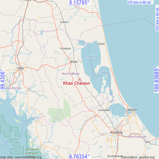
Khao Chaison GPS coordinates[2]
7° 27' 40.5" North, 100° 8' 1.392" East
| Map corner | latitude | longitude |
|---|---|---|
| Upper-left | 8.15785°, | 99.4306° |
| Center: | 7.46125°, | 100.13372° |
| Lower-right: | 6.76354°, | 100.83685° |
| Map W x H: | 155×155 km | = 96.3×96.3mi |
| max Lat: | 20.43353° ⇑93% North |
| Khao Chaison: | 7.46125° |
| min Lat: | ⇓7% South 5.77434° |
| min Long | Khao Chaison | max Long |
| 97.93288° | 100.13372° | 105.49506° |
| W 31.6%⇐ | ⇒68.4% E |
Elevation
Elevation of Khao Chaison is 23 m = 75 ft, and this is 102.5 m = 336 ft below average elevation for this country.
| Max E: |
1011 m = 3317 ft | 69.6% |
| Avg. | 125.5 m = 412 ft | |
| Khao Chaison | 23 m = 75 ft | |
Min E: |
1 m = 3 ft | 30.4% |
See also: Thailand elevation on elevation.city.
Geographical zone
Khao Chaison is located in North Torrid zone (between Equator and Tropic of Cancer). Distance of Equator is 829.6 km =515.5 mi to South.| Distance of | km | miles | from Khao Chaison |
|---|---|---|---|
| North Pole | 9177.4 | 5702.6 | to North |
| Arctic Circle | 6571.6 | 4083.4 | to North |
| Tropic Cancer | 1776.3 | 1103.7 | to North |
| Equator | 829.6 | 515.5 | to South |


Nearby cities:
15 places around Khao Chaison: (largest is in red/bold)
• Bang Kaeo
6 km =3.7 mi,  125°
125°
• Khuan Khanun
33.4 km =20.8 mi,  335°
335°
• Khuan Niang
38.6 km =24 mi,  141°
141°
• Kong Ra
21.3 km =13.2 mi,  252°
252°
• Krasae Sin
27.5 km =17.1 mi,  51°
51°
• Pa Bon
21.7 km =13.5 mi,  169°
169°
• Pa Phayom
48.4 km =30.1 mi,  330°
330°
• Pak Phayun
24.2 km =15 mi,  123°
123°
• Phatthalung
18.5 km =11.5 mi, 340°
• Ranot
40.8 km =25.4 mi,  30°
30°
• Rattaphum
38.7 km =24 mi,  159°
159°
• Sathing Phra
33.7 km =20.9 mi,  87°
87°
• Si Banphot
39.9 km =24.8 mi,  316°
316°
• Srinagarindra
24.2 km =15 mi,  299°
299°
• Tamot
13.8 km =8.6 mi,  190°
190°
Sources, notices
• [Note1] Compared only with cities in Thailand existing in our database
• [Src1] Map data: © OpenStreetMap contributors (CC-BY-SA)
• [Src2] Other city data from geonames.org with taken over terms of usage.
• [Src3] Geographical zone / Annual Mean Temperature by Robert A. Rohde @ Wikipedia
