Ban Hong geodata
Ban Hong (Lamphun) is a seat of a second-order administrative division; located in Thailand in Asia/Bangkok (GMT+7) time zone. In our database, there are 331 cities with bigger population. Compared to other cities in Thailand, 91.8% of cities are located further ↓South; 93.6% of cities are located further →East and 92.6% of cities have lower elevation than Ban Hong. Note1


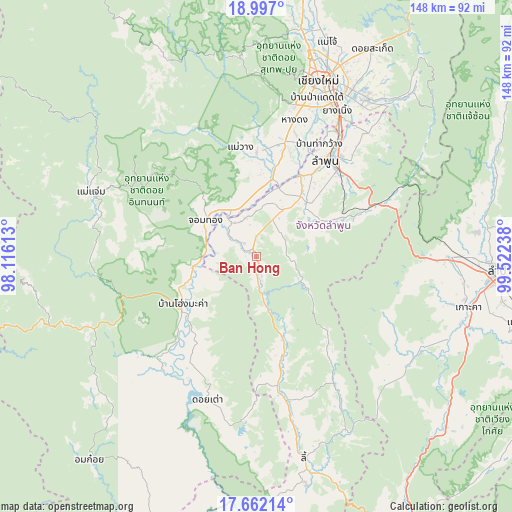
Ban Hong GPS coordinates[2]
18° 19' 51.096" North, 98° 49' 9.3" East
| Map corner | latitude | longitude |
|---|---|---|
| Upper-left | 18.997°, | 98.11613° |
| Center: | 18.33086°, | 98.81925° |
| Lower-right: | 17.66214°, | 99.52238° |
| Map W x H: | 148.4×148.4 km | = 92.2×92.2mi |
| max Lat: | 20.43353° ⇑8.2% North |
| Ban Hong: | 18.33086° |
| min Lat: | ⇓91.8% South 5.77434° |
| min Long | Ban Hong | max Long |
| 97.93288° | 98.81925° | 105.49506° |
| W 6.4%⇐ | ⇒93.6% E |
Elevation
Elevation of Ban Hong is 322 m = 1056 ft, and this is 196.5 m = 645 ft above average elevation for this country.
| Max E: |
1011 m = 3317 ft | 7.4% |
| Ban Hong | 322 m 1056 ft | |
| Avg. | 125.5 m = 412 ft | |
Min E: |
1 m = 3 ft | 92.6% |
See also: Thailand elevation on elevation.city.
Geographical zone
Ban Hong is located in North Torrid zone (between Equator and Tropic of Cancer). Distance of this Northern Tropic circle is 567.7 km =352.8 mi to North.| Distance of | km | miles | from Ban Hong |
|---|---|---|---|
| North Pole | 7968.9 | 4951.6 | to North |
| Arctic Circle | 5363 | 3332.4 | to North |
| Tropic Cancer | 567.7 | 352.8 | to North |
| Equator | 2038.2 | 1266.5 | to South |


Nearby cities:
15 places around Ban Hong: (largest is in red/bold)
• Ban Thi
45.9 km =28.5 mi,  43°
43°
• Chom Thong
18.1 km =11.2 mi,  302°
302°
• Doi Lo
15.1 km =9.4 mi,  343°
343°
• Doi Tao
44.4 km =27.6 mi,  198°
198°
• Hang Dong
41 km =25.5 mi,  14°
14°
• Hot
26.8 km =16.7 mi,  235°
235°
• Lamphun
34.1 km =21.2 mi, 35°
• Mae Chaem
51.5 km =32 mi,  291°
291°
• Mae Tha
37 km =23 mi,  66°
66°
• Mae Wang
32.1 km =19.9 mi,  351°
351°
• Pa Sang
25.1 km =15.6 mi,  30°
30°
• San Pa Tong
34 km =21.1 mi, 13°
• Saraphi
48.3 km =30 mi, 28°
• Thung Hua Chang
42.6 km =26.5 mi,  148°
148°
• Wiang Nong Long
12.4 km =7.7 mi,  323°
323°
Sources, notices
• [Note1] Compared only with cities in Thailand existing in our database
• [Src1] Map data: © OpenStreetMap contributors (CC-BY-SA)
• [Src2] Other city data from geonames.org with taken over terms of usage.
• [Src3] Geographical zone / Annual Mean Temperature by Robert A. Rohde @ Wikipedia
