Mae Tha geodata
Mae Tha (Lamphun) is a seat of a second-order administrative division; located in Thailand in Asia/Bangkok (GMT+7) time zone. With population of 10,048 people, there are 284 cities with bigger population in this country. Compared to other cities in Thailand, 92.5% of cities are located further ↓South; 89.9% of cities are located further →East and 96% of cities have lower elevation than Mae Tha. Note1


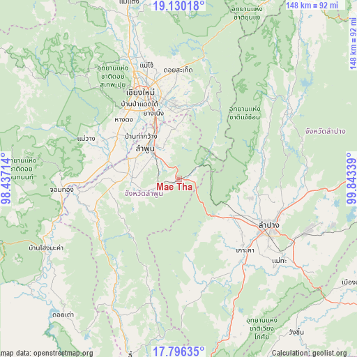
Mae Tha GPS coordinates[2]
18° 27' 52.416" North, 99° 8' 24.936" East
| Map corner | latitude | longitude |
|---|---|---|
| Upper-left | 19.13018°, | 98.43714° |
| Center: | 18.46456°, | 99.14026° |
| Lower-right: | 17.79635°, | 99.84339° |
| Map W x H: | 148.3×148.3 km | = 92.1×92.1mi |
| max Lat: | 20.43353° ⇑7.5% North |
| Mae Tha: | 18.46456° |
| min Lat: | ⇓92.5% South 5.77434° |
| min Long | Mae Tha | max Long |
| 97.93288° | 99.14026° | 105.49506° |
| W 10.1%⇐ | ⇒89.9% E |
Elevation
Elevation of Mae Tha is 406 m = 1332 ft, and this is 280.5 m = 920 ft above average elevation for this country.
| Max E: |
1011 m = 3317 ft | 4% |
| Mae Tha | 406 m 1332 ft | |
| Avg. | 125.5 m = 412 ft | |
Min E: |
1 m = 3 ft | 96% |
See also: Thailand elevation on elevation.city.
Geographical zone
Mae Tha is located in North Torrid zone (between Equator and Tropic of Cancer). Distance of this Northern Tropic circle is 552.9 km =343.6 mi to North.| Distance of | km | miles | from Mae Tha |
|---|---|---|---|
| North Pole | 7954 | 4942.4 | to North |
| Arctic Circle | 5348.1 | 3323.2 | to North |
| Tropic Cancer | 552.9 | 343.6 | to North |
| Equator | 2053.1 | 1275.7 | to South |


Nearby cities:
15 places around Mae Tha: (largest is in red/bold)
• Ban Hong
37 km =23 mi,  246°
246°
• Ban Thi
18.8 km =11.7 mi,  352°
352°
• Chiang Mai
39.8 km =24.7 mi,  335°
335°
• Doi Lo
38.2 km =23.7 mi,  269°
269°
• Hang Chat
26.5 km =16.5 mi,  124°
124°
• Hang Dong
34 km =21.1 mi,  316°
316°
• Ko Kha
40.4 km =25.1 mi,  138°
138°
• Lampang
41.8 km =26 mi, 117°
• Lamphun
19 km =11.8 mi,  312°
312°
• Mae On
36.5 km =22.7 mi,  18°
18°
• Pa Sang
22.3 km =13.9 mi,  287°
287°
• San Kamphaeng
31.2 km =19.4 mi,  355°
355°
• San Pa Tong
31.6 km =19.6 mi, 305°
• Saraphi
29.9 km =18.6 mi, 338°
• Wiang Nong Long
41.5 km =25.8 mi,  263°
263°
Sources, notices
• [Note1] Compared only with cities in Thailand existing in our database
• [Src1] Map data: © OpenStreetMap contributors (CC-BY-SA)
• [Src2] Other city data from geonames.org with taken over terms of usage.
• [Src3] Geographical zone / Annual Mean Temperature by Robert A. Rohde @ Wikipedia
